Lydden
Civil parishes in KentKent geography stubsVillages in Kent

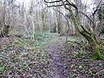
Lydden is a civil parish and small village in the Dover district of Kent, England. The Lydden Race Circuit is located between here and Wootton to the west of the village. Lydden village consists of a triangle of 3 roads: Canterbury Road (part of the old A2 running between Dover, Canterbury and London), Stonehall and Church Lane. Lydden is set in a steep sided valley landscape, with grazing pasture and pockets of woodland along the valley side facing north west, and the extensive Lydden and Temple Ewell Downs National Nature Reserve facing south west. The NNR is famous for its chalk grassland habitat and species including the adonis blue butterfly.
Excerpt from the Wikipedia article Lydden (License: CC BY-SA 3.0, Authors, Images).Lydden
Church Lane,
Geographical coordinates (GPS) Address Nearby Places Show on map
Geographical coordinates (GPS)
| Latitude | Longitude |
|---|---|
| N 51.1642 ° | E 1.234 ° |
Address
Church Lane
Church Lane
CT15 7JP , Lydden
England, United Kingdom
Open on Google Maps


