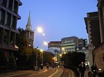
Houndsditch
Streets in the City of LondonUse British English from May 2017

Houndsditch is a street running through parts of the Portsoken and Bishopsgate Without wards of the City of London; areas which are also a part of the East End of London. The road follows the line of the outside edge of the ditch which once ran outside the London Wall. The road Houndsditch took its name from the section of ditch between Bishopsgate and Aldgate. The name may derive from the widespread dumping of rubbish in this stretch of ditch; relating to the dumping of dead dogs, or the scavenging of the waste by feral dogs.
Excerpt from the Wikipedia article Houndsditch (License: CC BY-SA 3.0, Authors, Images).Houndsditch
Houndsditch, City of London
Geographical coordinates (GPS) Address Nearby Places Show on map
Geographical coordinates (GPS)
| Latitude | Longitude |
|---|---|
| N 51.5153 ° | E -0.0787 ° |
Address
Temples
Houndsditch 44
EC3A 7DB City of London
England, United Kingdom
Open on Google Maps


