Leziate
Civil parishes in NorfolkDeserted medieval villages in NorfolkKing's Lynn and West NorfolkVillages in Norfolk

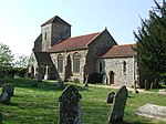
Leziate is a village and civil parish in the English county of Norfolk. The village is 44 miles (71 km) west of Norwich, 5.7 miles (9.2 km) east of King's Lynn and 106 miles (171 km) north-north-east of London. The Village is located a small distance south of the B1145 a route which runs between King's Lynn and Mundesley. The nearest railway station is at King's Lynn for the Fen Line which runs between King's Lynn and Cambridge. The nearest airport is Norwich International Airport. The parish of Leziate in the 2001 census, has a population of 581, including Ashwicken and increasing to 592 at the 2011 census.
Excerpt from the Wikipedia article Leziate (License: CC BY-SA 3.0, Authors, Images).Leziate
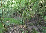
Holthouse Lane, King's Lynn and West Norfolk Leziate
Geographical coordinates (GPS) Address Nearby Places Show on map
Geographical coordinates (GPS)
| Latitude | Longitude |
|---|---|
| N 52.739291 ° | E 0.479997 ° |
Address
Holthouse Lane
Holthouse Lane
PE32 1EL King's Lynn and West Norfolk, Leziate
England, United Kingdom
Open on Google Maps


