The Hale
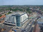
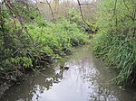
The Hale is an area and ward within the London Borough of Barnet. It is situated where the eastern part of Edgware meets the western part of Mill Hill and centres on the small retail centre at the junction of Deans Lane, Hale Lane and Selvage Lane. This centre constitutes Upper Hale, but is much better known locally as the 'Green Man' after the erstwhile pub of the same name that stood at the site from at least the early 18th century. A smaller area that was traditionally known as Lower Hale centres on the junction of Hale Lane, Farm Road and the nearby bridge over Deans Brook; this latter area is generally regarded as being within Edgware. The traditional area known as The Hale extends northwards from the 'Green Man' to the A41 and Apex Corner and the southern end is traditionally marked by the disused Edgware and Highgate railway line just south of West Way and Hale Drive; beyond lies Burnt Oak. Today's borough ward has slightly larger boundaries.
Excerpt from the Wikipedia article The Hale (License: CC BY-SA 3.0, Authors).The Hale
Northolm, London
Geographical coordinates (GPS) Address Nearby Places Show on map
Geographical coordinates (GPS)
| Latitude | Longitude |
|---|---|
| N 51.62 ° | E -0.26 ° |
Address
Northolm
Northolm
HA8 9RL London (London Borough of Barnet)
England, United Kingdom
Open on Google Maps


