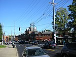
Tyler Park, Louisville
1873 establishments in KentuckyNeighborhoods in Louisville, KentuckyPopulated places established in 1873

Tyler Park is a neighborhood three miles (5 km) southeast of downtown Louisville, Kentucky, USA. It is considered a part of a larger area of Louisville called The Highlands. Near the middle of the neighborhood is a city park of the same name, and many houses in the neighborhood feature park views. The neighborhood boundaries are St Louis Cemetery to the north, Bardstown Road to the east, Eastern Parkway to the south and Beargrass Creek to the west.
Excerpt from the Wikipedia article Tyler Park, Louisville (License: CC BY-SA 3.0, Authors, Images).Tyler Park, Louisville
Baxter Avenue, Louisville
Geographical coordinates (GPS) Address Nearby Places Show on map
Geographical coordinates (GPS)
| Latitude | Longitude |
|---|---|
| N 38.2309 ° | E -85.7166 ° |
Address
Baxter Avenue
40204 Louisville
Kentucky, United States
Open on Google Maps


