Cherokee Triangle, Louisville
1870 establishments in KentuckyHistoric districts on the National Register of Historic Places in KentuckyHistory of Louisville, KentuckyLocal preservation districts in Louisville, KentuckyNRHP infobox with nocat ... and 6 more
National Register of Historic Places in Louisville, KentuckyNeighborhoods in Louisville, KentuckyPopulated places established in 1870Streetcar suburbsTourist attractions in Louisville, KentuckyUse mdy dates from August 2023

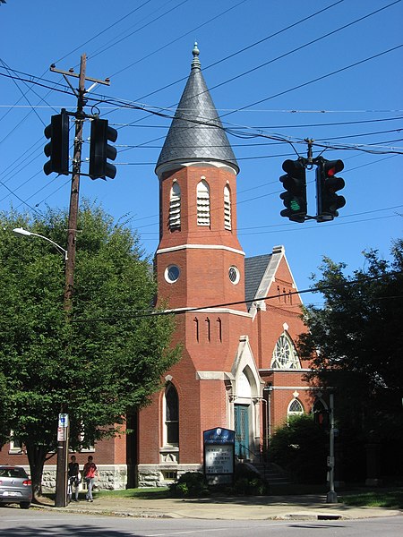
The Cherokee Triangle is a historic neighborhood in Louisville, Kentucky, USA, known for its large homes displaying an eclectic mix of architectural styles. Its boundaries are Bardstown Road to the southwest, Cherokee Park and Eastern Parkway to the southeast, and Cave Hill Cemetery to the north, and is considered a part of a larger area of Louisville called The Highlands. It is named for nearby Cherokee Park, a 409 acres (1.7 km2) park designed by Frederick Law Olmsted, the designer of New York's Central Park.
Excerpt from the Wikipedia article Cherokee Triangle, Louisville (License: CC BY-SA 3.0, Authors, Images).Cherokee Triangle, Louisville
Cherokee Parkway, Louisville
Geographical coordinates (GPS) Address Nearby Places Show on map
Geographical coordinates (GPS)
| Latitude | Longitude |
|---|---|
| N 38.23526857 ° | E -85.71244061 ° |
Address
Cherokee Parkway 2102
40204 Louisville
Kentucky, United States
Open on Google Maps


