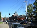
Deer Park, Louisville

Deer Park is a neighborhood four miles southeast of downtown Louisville, Kentucky, USA. Most of the neighborhood was developed from 1890 through the 1920s as a streetcar suburb, with all but six of its 24 subdivisions being developed by 1917, and the last laid out by 1935, although some development west of Norris Place continued after World War II.Deer Park's boundaries are Bardstown Road, Newburg Road, Eastern Parkway and Douglass Boulevard. Deer Park is considered a part of a larger area of Louisville called The Highlands. Prior to subdivision, it was agricultural. The origin of the name is not entirely clear, although recent campaigns to "put the deer back in Deer Park" have seen colorful deer sculptures placed at local businesses, parodying a Louisville-wide campaign with larger horse sculptures placed similarly.
Excerpt from the Wikipedia article Deer Park, Louisville (License: CC BY-SA 3.0, Authors, Images).Deer Park, Louisville
Norris Place, Louisville
Geographical coordinates (GPS) Address Nearby Places Show on map
Geographical coordinates (GPS)
| Latitude | Longitude |
|---|---|
| N 38.2234 ° | E -85.7058 ° |
Address
Highland Junior High School
Norris Place 1700
40205 Louisville
Kentucky, United States
Open on Google Maps


