Candleston Castle
Castle ruins in WalesCastles in Bridgend County BoroughGrade II* listed buildings in Bridgend County BoroughGrade II* listed castles in WalesUse British English from May 2015

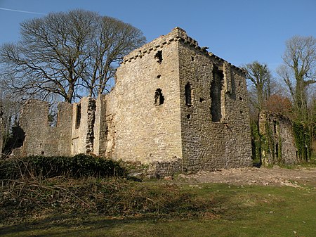
Candleston Castle (historically sometimes Candlestone Castle) is a 14th-century fortified manor house, in ruins since the 19th century. It is 0.75 miles (1.2 km) southwest of Merthyr Mawr, Glamorgan, Wales, now Bridgend County Borough and just 0.75 miles (1.2 km) northwest of Ogmore Castle, separated by the River Ogmore. Candleston's original long and narrow rectangular structure lay across the western end of a low narrow promontory, suggesting a defensive position. The castle is believed to be named after the Norman family of Cantilupe, thought to be its first feudal tenants.
Excerpt from the Wikipedia article Candleston Castle (License: CC BY-SA 3.0, Authors, Images).Candleston Castle
Merthyr Mawr Road,
Geographical coordinates (GPS) Address Nearby Places Show on map
Geographical coordinates (GPS)
| Latitude | Longitude |
|---|---|
| N 51.4825 ° | E -3.6273 ° |
Address
Merthyr Mawr Road
CF32 0LS , Merthyr Mawr
Wales, United Kingdom
Open on Google Maps


