RAF Collyweston
1917 establishments in EnglandMilitary units and formations established in 1917Royal Air Force stations in NorthamptonshireUse British English from November 2017

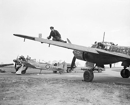
RAF Collyweston is a former Royal Air Force satellite station located 3.2 miles (5.1 km) south west of Stamford, Lincolnshire and 11 miles (18 km) north east of Corby, Northamptonshire, England. The airfield was a satellite station of RAF Wittering and used by the Enemy Aircraft Flight during the Second World War.
Excerpt from the Wikipedia article RAF Collyweston (License: CC BY-SA 3.0, Authors, Images).RAF Collyweston
Great North Road,
Geographical coordinates (GPS) Address Nearby Places Show on map
Geographical coordinates (GPS)
| Latitude | Longitude |
|---|---|
| N 52.603 ° | E -0.502 ° |
Address
RAF Wittering
Great North Road
PE9 3JR
England, United Kingdom
Open on Google Maps


