place

Middleton Lodge

Country houses in North Yorkshire
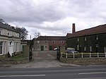
ExteriorofpresentdayMiddletonLodge

Middleton Lodge is a Georgian Palladian mansion set within 200 acres (0.81 km2) of open countryside, on the outskirts of the village of Middleton Tyas, a mile or so off the A1 near Scotch Corner and a 15-minute drive from Darlington, County Durham. Middleton Lodge was designed by the architect John Carr, and was built between 1777-1780 for George Hartley Esquire.The Hartley family was one of the major land owning families in the area. George's father, Leonard Hartley, lived in East Hall, one of the larger houses in Middleton Tyas. The Hartleys continued to live in Middleton Lodge until the late 1870s. In 1890 The Hon. Mrs Margaret Dundas, widow of the Hon. John Charles Dundas, MP (1808-1866), is recorded as living there. She died in 1907. It was later the family home of coal owner Sir Arthur Pease, 1st Baronet, who died there in 1927. Middleton Lodge is still a family home to the Allison family who have lived there since 1980, however it is now also available for exclusive hire for private wedding receptions and functions. It was the filming location for the television film Perfect Day and the Hindu-language children's film Hari Puttar: A Comedy of Terrors.

Excerpt from the Wikipedia article Middleton Lodge (License: CC BY-SA 3.0, Authors, Images).

Middleton Lodge
Kneeton Lane,

Geographical coordinates (GPS) Address Nearby Places
placeShow on map

Wikipedia: Middleton LodgeContinue reading on Wikipedia

Geographical coordinates (GPS)

Latitude Longitude
N 54.458 ° E -1.66 °
placeShow on map

Address

Kneeton Lane
DL10 6NL , Middleton Tyas
England, United Kingdom
mapOpen on Google Maps

ExteriorofpresentdayMiddletonLodge
Share experience

Nearby Places

Scot's Dyke

Scot’s Dyke, also known as the Scots Dyke or the Scots Dike, is a linear earthwork in the district of Richmondshire in the county of North Yorkshire, England. It is about fourteen kilometres (8.5 miles) long and runs from the river Swale to the river Tees. Camden in Britannia says: “and neere at hand there is seene a ditch by Stanwig a little village, that runneth eight miles in length betweene the river Tees and Swale.” The Scot’s Dyke varies in size and form throughout its length, which show that each section was built by a separate group of workers. South of the A66 road the dyke had a bank up to 1.5 metres (4 ft 11 in) high and 10m wide with a ditch 7 metres (23 ft) wide and 1 metre (3 ft 3 in) deep. On the eastern side of the ditch traces could be seen of a counterscarp bank approximately 5m wide.Parts of the dyke are possibly a double dyke (two banks with a ditch in the middle) as shown by the Ordnance Survey maps at the northern end of the dyke. A link with the earthworks of the oppidum at Stanwick near the northern end of the dyke would make sense but there is no evidence of this. Excavations in advance of the A66 road improvements in 2006-2007 gave an opportunity for the dyke to be investigated. No artefacts were recovered from the excavation and the relationship between the Scot’s Dyke and the Roman road was not established but samples of the ditch fills were taken for dating: “Archaeomagnetic dating of sediment fills from Scots Dyke in 2006 provided results suggesting that the feature was starting to fill up in the period from the first century BC to the first century AD.”The Scot's Dyke should not be confused with the Scots' Dike that marks part of the border between England and Scotland.