Schwamendingen Mitte
Canton of Zürich geography stubsDistrict 12 of ZürichFormer municipalities of the canton of Zürich

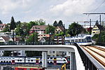
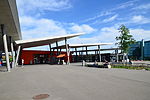
Schwamendingen Mitte (Schwamendingen centre) is a quarter in the district 12 in Zürich, located in the Glatt Valley (German: Glattal). Schwamendingen and Oerlikon became independent municipalities in 1872. These were incorporated into the city of Zürich in 1934, together with Seebach, Affoltern, Witikon, Höngg, Altstetten and Albisrieden. After 1934 Schwamendingen was divided into the quarters Schwamendingen Mitte, Saatlen and Hirzenbach. The quarter has a population of 10,322 distributed over an area of 2.23 km2 (0.86 sq mi).
Excerpt from the Wikipedia article Schwamendingen Mitte (License: CC BY-SA 3.0, Authors, Images).Schwamendingen Mitte
Glattwiesenstrasse, Zurich Kreis 12
Geographical coordinates (GPS) Address Nearby Places Show on map
Geographical coordinates (GPS)
| Latitude | Longitude |
|---|---|
| N 47.4042 ° | E 8.5819805555556 ° |
Address
Glattwiesenstrasse
Glattwiesenstrasse
8051 Zurich, Kreis 12
Zurich, Switzerland
Open on Google Maps


