place

Heenvliet

Former municipalities of South HollandNissewaardPages with non-numeric formatnum argumentsPopulated places in South HollandSouth Holland geography stubs
Heenvliet 009
Heenvliet 009

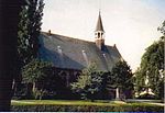
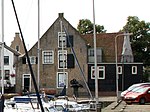
Heenvliet is a town in the Dutch province of South Holland. It is a part of the municipality of Nissewaard, and lies about 7 km south of Maassluis, on the Brielse Maas. Heenvliet was a separate municipality until 1980, when it became part of Bernisse.In 2001, the town of Heenvliet had 2,675 inhabitants. The built-up area of the town was 0.36 km2, and contained 1,064 residences. The wider statistical district of Heenvliet, which covers that part of the "Polder Heenvliet" that is in Bernisse, has a population of around 2,700. The historic ruins of Ravesteyn Castle are located in the town.

Excerpt from the Wikipedia article Heenvliet (License: CC BY-SA 3.0, Authors, Images).

Heenvliet
Wieldijk, Nissewaard

Geographical coordinates (GPS) Address Nearby Places
placeShow on map

Wikipedia: HeenvlietContinue reading on Wikipedia

Geographical coordinates (GPS)

Latitude Longitude
N 51.866666666667 ° E 4.25 °
placeShow on map

Address

WSV de kleine Bernisse

Wieldijk 1
3218 LL Nissewaard
South Holland, Netherlands
mapOpen on Google Maps

Heenvliet 009
Heenvliet 009
Share experience

Nearby Places

Blankenburg (Rozenburg)

Blankenburg is a former village that was located on the Dutch island of Rozenburg in the province of South Holland. It was located to the west of Rotterdam and to the southeast of the village of Rozenburg and was part of the Blankenburg island polder of the same name, which was created around 1600 by migrants from Blankenberge in Flanders. Soon after, it formed a single island with Rozenburg and a few embankments in the Maas estuary. The village that originated in the seventeenth century was completely abandoned in the early 1960s due to the construction of Europoort. One of the first inhabitants of the island was Willem Pietersz. Moerman (ca.1575-1648), a farmer, birdwatcher and hunter who fled from Flanders during the Eighty Years' War. He is probably the one who gave the island the name Blankenburg, after the town of Blankenberge where he came from. Within a century, the settlement grew into a village with its own church and courthouse.Until the beginning of the 20th century the village of Blankenburg was the center of the island. Here stood the church, the school and the court house. There was also a ferry connection over the Brielse Maas with Nieuwesluis on the island Voorne-Putten. After 1900 the center was increasingly located on the Maassluis side of the island, in the village that was named Rozenburg but was initially called 'De Buurt' (Dutch for the neighbourhood). Until 1965 Blankenburg was a village of approximately 400 inhabitants and 130 houses that were built along various dikes. In 1960 the municipality of Rotterdam expropriated the houses and farms for the construction of the Europoort industrial area. The Rotterdam band The Amazing Stroopwafels wrote a song about the village. The name 'Blankenburg' also lives on in the name of a still existing football club. The name of the Blankenburg Tunnel connection which is currently under construction refers to the former polder.