place

Tremont Avenue–177th Street station
1891 establishments in New York (state)1973 disestablishments in New York (state)Bronx building and structure stubsDefunct New York City Subway stations located abovegroundFormer elevated and subway stations in the Bronx
IRT Third Avenue Line stationsNew York City railway station stubsRailway stations closed in 1973Railway stations in the United States opened in 1891Third AvenueTremont, Bronx
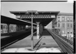
NORTHBOUND PLATFORM AT EAST TREMONT AVENUE STATION, GENERAL VIEW IS NORTH. Interborough Rapid Transit Company, Third Avenue Elevated Line, Borough of the Bronx, New York, New HAER NY,3 BRONX,13 53

The Tremont Avenue–177th Street station, at times associated as Bronx Borough Hall, was an express station on the demolished IRT Third Avenue Line in the Bronx, New York City. It was built by the Suburban Rapid Transit Company as 177th Street Station and had three tracks and two island platforms. It opened on July 20, 1891, and was the northern terminus of the Third Avenue elevated line until 1901, when more stations opened as the line was extended north. The next stop to the north was 180th Street for local trains and Fordham Road–190th Street for express trains. The next stop to the south for all trains was 174th Street. In its last years, a reconstructed section rose over the Cross Bronx Expressway at approximately 175th Street as part of the highway's development.The station closed on April 29, 1973 and was demolished by 1977.It was notable for being the station that served Bronx Borough Hall (1897–1969).

Excerpt from the Wikipedia article Tremont Avenue–177th Street station (License: CC BY-SA 3.0, Authors, Images).

Tremont Avenue–177th Street station
East Tremont Avenue, New York The Bronx

Geographical coordinates (GPS) Address Nearby Places
placeShow on map

Wikipedia: Tremont Avenue–177th Street stationContinue reading on Wikipedia

Geographical coordinates (GPS)

Latitude Longitude
N 40.846666666667 ° E -73.896111111111 °
placeShow on map

Address

East Tremont Avenue 531
10457 New York, The Bronx
New York, United States
mapOpen on Google Maps

NORTHBOUND PLATFORM AT EAST TREMONT AVENUE STATION, GENERAL VIEW IS NORTH. Interborough Rapid Transit Company, Third Avenue Elevated Line, Borough of the Bronx, New York, New HAER NY,3 BRONX,13 53
Share experience

Nearby Places

West Bronx

The West Bronx is a region in the New York City borough of the Bronx. The region lies west of the Bronx River and roughly corresponds to the western half of the borough. The West Bronx is more densely populated than the East Bronx, and is closer to Upper Manhattan. From the late 17th century to the middle 19th century this included the central and southern part of the Town of Yonkers, but then became the separate Town of Kingsbridge. In 1874, the then towns of Kingsbridge, West Farms and Morrisania were transferred to New York County, becoming the first area outside Manhattan to be annexed by the City of New York. Today's West Bronx was then known as the "Annexed District". In 1895, the city annexed the modern-day East Bronx, followed in 1898 by western Queens County (today's borough of Queens, with the remainder of what was eastern Queens County becoming the newly formed Nassau County), all of the City of Brooklyn (today's borough of Brooklyn), and all of Richmond County (today's borough of Staten Island) to form the consolidated city of New York.Physically, the western parts of the Bronx are hilly, dominated by a series of parallel ridges running south to north. The West Bronx has older tenement buildings, low income public housing complexes, multifamily homes in its lower income areas as well as larger single family homes in more affluent areas such as Riverdale. It includes New York City's third largest park: Van Cortlandt Park which runs along the Westchester-Bronx border. The Grand Concourse, a wide ridgeline boulevard runs through the area from north to south. Because the West Bronx uses the same street numbering system as Manhattan, large portions of streets designated as "east" (e.g., East 161st Street) may actually be located west of the Bronx River. This is because the east-west divider is Fifth Avenue in Manhattan and Jerome Avenue in the Bronx, which is directly north of Fifth Avenue. Jerome Avenue was approximately the centerline of the original Annexed District, though not of the expanded modern Bronx.Prior to the 1970s, New Yorkers generally saw the Bronx as being split into its eastern and western halves. However, with the urban decay that hit the southwestern Bronx starting in the 1960s, people began to see the borough as being fundamentally divided between the southwestern area ("The South Bronx") and everywhere else.