place

Connaught Park Racetrack

1913 establishments in QuebecBuildings and structures in GatineauDefunct horse racing venues in CanadaHorse racing venues in QuebecSport in Gatineau
Sports venues in Quebec
Maison Samuel Stewart 05

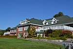
Connaught Park, later known as Hippodrome d'Aylmer, was a thoroughbred, steeplechase and harness racing track, later having a casino and live betting parlor, that operated from 1913 until 2009. The track was located in the Aylmer, Quebec district of Gatineau, Quebec, Canada, near Ottawa, Ontario. It had two tracks: a one-mile dirt track used until 1954 for thoroughbred racing, and a half-mile dirt track, used for harness racing. Racing ended in 2008 after its owner declared bankruptcy. The site was sold in 2009 for a housing development.

Excerpt from the Wikipedia article Connaught Park Racetrack (License: CC BY-SA 3.0, Authors, Images).

Connaught Park Racetrack
Avenue de l'Hippodrome, Gatineau Aylmer

Geographical coordinates (GPS) Address Nearby Places
placeShow on map

Wikipedia: Connaught Park RacetrackContinue reading on Wikipedia

Geographical coordinates (GPS)

Latitude Longitude
N 45.400303 ° E -75.799012 °
placeShow on map

Address

Avenue de l'Hippodrome 335
J9H 0J3 Gatineau, Aylmer
Quebec, Canada
mapOpen on Google Maps

Maison Samuel Stewart 05
Share experience

Nearby Places

Hull—Aylmer
Hull—Aylmer

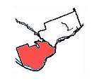
Hull—Aylmer (formerly known as Hull) is a federal electoral district in Quebec, Canada, that has been represented in the House of Commons of Canada since 1917. It was created as "Hull" in 1914 from parts of Labelle and Wright ridings. It was renamed "Hull—Aylmer" in 1984. It encompasses the parts of the sectors of Hull and Aylmer located in the city of Gatineau, Quebec. The neighbouring ridings are Gatineau, Pontiac, Ottawa West—Nepean, Ottawa Centre, and Ottawa—Vanier. With its large percentage of civil servants, the riding was a Liberal stronghold for almost a century, and the safest Liberal riding in the province outside Greater Montreal. Even when the rest of the province was turning its back on the Liberals, they survived in Hull—Aylmer in 1984, 2004 and 2006. In 2008, however, it was the only riding in Canada where four candidates received over 15% of the vote, and was the only riding in Quebec outside the Montreal area the Liberals won. In a major turnaround during the 2011 elections, however, the New Democratic Party won the riding as part of its sweep of the Outaouais. To date, this is the only time the Liberals have lost this riding in an election. The winner of that election, Nycole Turmel, was the interim leader of the NDP from July 28, 2011 until March 24, 2012, following the death of NDP leader Jack Layton. The only other time it was out of Liberal hands was from 1990 to 1993, when Gilles Rocheleau crossed the floor to the Bloc Québécois. Hull—Aylmer lost territory to Pontiac during the 2012 electoral redistribution. It reverted to form at the 2015 election, when Liberal Greg Fergus handily defeated Turmel as part of the Liberals' clean sweep of the Outaouais.

Lincoln Heights, Ottawa

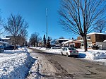
Lincoln Heights (also known as Lincoln Heights - Parkway) is a neighbourhood in the Britannia area of Bay Ward in the west end of Ottawa, Ontario, Canada. It is defined by its community association as being bounded to the south by the north side of Regina Lane (now Starflower Lane), to the north by the Ottawa River, to the west by the east side of Croydon Avenue, and to the east by the Kichi Zibi Mikan (formerly the Sir John A. Macdonald Parkway). According to the Canada 2016 Census, the population of the neighbourhood is 1,630. The greater Lincoln Heights area can be defined as extending as far west as Greenview Avenue and as far south as Carling Avenue, which overlaps with neighbouring Britannia Village. The area is notable for its proximity to the Ottawa River and Mud Lake bird sanctuary. Lincoln Fields transit station is the main transit hub in the neighbourhood, and Lincoln Fields Shopping Centre was the main commercial centre before closing in 2019. Construction plans for the neighbourhood were announced in 1958 by Assaly Construction Limited, with plans for a $20,000,000 "luxury sub-division" on the site of the Magee farm. The neighbourhood began to be built c. 1960 on Regina Street. Following the removal of the Canadian Pacific Railway line (where today's Plover Lane is), the neighbourhood expanded further north in the early 1970s with the construction of Lincoln Heights Road.There are many high-rise condominiums and apartments in the neighbourhood. The Old Forge Community Resource Centre, which is located in a historic building, is a key community centre. Carlingwood Shopping Centre is just east of Lincoln Fields at the corner of Carling and Woodroffe Avenue.