place

Shorefront Park

Parks in Suffolk County, New YorkPatchogue, New York
Shorefront Park Patchogue

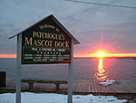
Shorefront Park and the Patchogue Village Band Shell are located on Smith Street at the south end of Rider Avenue, Patchogue, New York.Since 2007, the Park has undergone updates by the village of Patchogue. There has been replacement of the older Band shell to a more contemporary style has been replaces. The new venue served as the geographical host for the Great South Bay music festival in 2010. 'Rider Avenue Park' is located directly opposite or north of Shorefront Park. This park has 3 baseball diamonds, basketball courts, hiking trails, bleacher stands, and serves local sports activities. The park is surrounded by tall beach grass with a natural lake.

Excerpt from the Wikipedia article Shorefront Park (License: CC BY-SA 3.0, Authors, Images).

Shorefront Park
Smith Street,

Geographical coordinates (GPS) Address Nearby Places
placeShow on map

Wikipedia: Shorefront ParkContinue reading on Wikipedia

Geographical coordinates (GPS)

Latitude Longitude
N 40.748888888889 ° E -73.007222222222 °
placeShow on map

Address

Smith Street 47
11772
New York, United States
mapOpen on Google Maps

Shorefront Park Patchogue
Share experience

Nearby Places

Swan River (New York)

The Swan River is in Suffolk County on Long Island, New York. It flows into Swan Lake from the north, and then south out of the lake into the mouth of Patchogue Bay, which then becomes the Great South Bay. Originally, the headwaters reached as far north as Medford, New York, near the vicinity of the Long Island Rail Road's Medford station. Swan River is a relatively clean, cold, free flowing, freshwater stream, generally less than 15 feet wide, with a sandy substrate. This segment of the river flows through much undeveloped forested wetland, but has also been encroached upon by residential development, road construction, and a commercial sand mining operation. Below Montauk Highway, the river is tidal, and is bordered by undeveloped marshland and limited development of boat docking facilities. The fish and wildlife habitat encompasses the entire river, including an approximate one and one-half mile tidal segment, and an approximate two and one-half mile freshwater segment, which extends from Swan Lake, above Montauk Highway, to the headwaters of the stream, above Swan Lake, flowing southward into Patchogue Bay. Swan River is one of only a few free-flowing, spring-fed streams on Long Island that have remained in a relatively natural state. Above Swan Lake, this creek provides habitat conditions suitable for natural reproduction by brook trout, and supports one of approximately 6 known wild populations of this species on Long Island. In addition to native fish populations in Swan River, concentrations of sea-run brown trout occur in the tidal segment below Montauk Highway, during their fall spawning period (September–November). The concentrations of salmonids in Swan River support a recreational fishery of county-level significance. However, no formal public access to the area has been developed. No unusual concentrations of any wildlife species are known to occur in the area. A few local marinas and untouched wild life are spread throughout its almost 2 mile run There are residential homes spread throughout the river's edge.