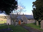
Moel Fferna
Clwyd geography stubsHewitts of WalesMountains and hills of DenbighshireMountains and hills of Wrexham County BoroughNuttalls

Moel Fferna is a mountain in Denbighshire, Wales and forms part of the Berwyn range. It is the most northern outpost of the range. The summit is covered in deep heather and has a shelter cairn. A trig point was used to mark the summit, but has since been destroyed. To the south is Pen Bwlch Llandrillo, followed by Cadair Bronwen. It is the highest peak in the Clwydian Range and Dee Valley Area of Outstanding Natural Beauty.
Excerpt from the Wikipedia article Moel Fferna (License: CC BY-SA 3.0, Authors, Images).Moel Fferna
Berwyn Street,
Geographical coordinates (GPS) Address Nearby Places Show on map
Geographical coordinates (GPS)
| Latitude | Longitude |
|---|---|
| N 52.94824 ° | E -3.31586 ° |
Address
Berwyn Street
LL21 9ES , Corwen
Wales, United Kingdom
Open on Google Maps


