Birdland, San Diego

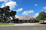
Birdland is a neighborhood in San Diego, California. It is located between California State Route 163, Interstate 805 and Mission Valley. Most of the streets in the area are named after different bird species, hence the name of the community. Birdland should not be confused with Bird Rock, a neighborhood of La Jolla, nor with the area of Mission Hills where the streets are also named for birds. Although identified as a separate community, Birdland is within the city of San Diego’s Serra Mesa Planning Area. Birdland is located in City Council District 7 and is currently represented by Councilmember Scott Sherman. Most of Birdland was developed in the late 1950s and early 1960s. In planning documents, the area is identified as "El Dorado." While much of the neighborhood consists of single-family homes, there are also three large apartment communities. The area is best known for its medical facilities, including: Donald N. Sharp Memorial Hospital Sharp Mary Birch Hospital for Women & Newborns Rady Children's Hospital Sharp Memorial Outpatient Pavilion Sharp Mesa Vista Hospital Ronald McDonald House Charities of San DiegoThe area also houses a juvenile detention facility: San Diego Juvenile Hall.
Excerpt from the Wikipedia article Birdland, San Diego (License: CC BY-SA 3.0, Authors, Images).Birdland, San Diego
Pheasant Drive, San Diego Linda Vista
Geographical coordinates (GPS) Address Nearby Places Show on map
Geographical coordinates (GPS)
| Latitude | Longitude |
|---|---|
| N 32.788861111111 ° | E -117.15511388889 ° |
Address
Pheasant Drive 2590
92123 San Diego, Linda Vista
California, United States
Open on Google Maps


