place

Zavrh pod Šmarno Goro

Osrednjeslovenska statistical region geography stubsPopulated places in the Municipality of Medvode
Zavrh pod Smarno Goro Slovenia

Zavrh pod Šmarno Goro (pronounced [ˈzaːʋəɾx pɔt ˈʃmaːɾnɔ ˈɡɔːɾɔ]; Slovene: Zavrh pod Šmarno goro) is a settlement in the Municipality of Medvode in the Upper Carniola region of Slovenia.

Excerpt from the Wikipedia article Zavrh pod Šmarno Goro (License: CC BY-SA 3.0, Authors, Images).

Zavrh pod Šmarno Goro
Zavrh pod Šmarno goro, Upravna Enota Ljubljana

Geographical coordinates (GPS) Address Nearby Places
placeShow on map

Wikipedia: Zavrh pod Šmarno GoroContinue reading on Wikipedia

Geographical coordinates (GPS)

Latitude Longitude
N 46.136833333333 ° E 14.457958333333 °
placeShow on map

Address

Zavrh pod Šmarno goro 7
1211 Upravna Enota Ljubljana
Slovenia
mapOpen on Google Maps

Zavrh pod Smarno Goro Slovenia
Share experience

Nearby Places

Mount Saint Mary
Mount Saint Mary

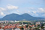
Mount Saint Mary (Slovene: Šmarna gora, German: Großkahlenberg), originally known as Holm, is an inselberg in the north of Ljubljana, the capital of Slovenia. The mountain is part of the city's Šmarna Gora District. It is the highest hill in the city and a popular hiking destination.The two-peaked mountain resembles the humps of a Bactrian camel or woman's breasts, and it has two peaks: Mount Saint Mary (Šmarna gora; 669 metres, 2,195 ft) to the east and Grmada (676 m, 2,218 ft) to the west. The toponym contains the archaic contraction Šmarna for Sveta Marijina 'St. Mary's'. The name of the western peak, Grmada, literally means 'heap, pile (of wood for a bonfire)'. The slightly lower eastern peak lends its name to the mountain as a whole. In clear conditions, the mountain offers a view across much of Slovenia, from Mount Triglav and Mount Stol on the northeastern Austrian–Italian border to Mount Krim, Mount Snežnik, and Trdina Peak (Slovene: Trdinov vrh) on the Croatian border to the southwest. Nearby hills include Bare Hill (Golo brdo), Tošč Face (Toško čelo), Rožnik, and Rašica. The hill is surrounded by the villages of Vikrče and Spodnje Pirniče to the west, Zavrh pod Šmarno Goro to the north, and the former villages (now part of Ljubljana) of Šmartno pod Šmarno Goro and Tacen to the southeast. The southern slope of the mountain is wooded with downy oak and hop hornbeam, while the northern slope is covered by a beech forest. The bell tower on the top of the mountain rings each day half an hour before midday.