place

Thornton-Cleveleys

Geography of the Borough of WyreThe FyldeUnparished areas in LancashireUse British English from July 2012

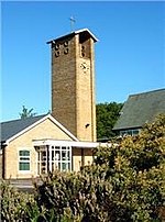
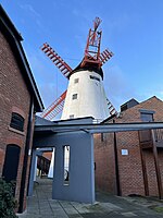
Thornton-Cleveleys is a conurbation consisting of the village of Thornton and the town of Cleveleys. The two settlements formed a joint urban district from 1927 until 1974, before becoming part of Wyre. The two settlements constitute part of the Blackpool Urban Area.

Excerpt from the Wikipedia article Thornton-Cleveleys (License: CC BY-SA 3.0, Authors).

Thornton-Cleveleys
Victoria Road East, Borough of Wyre Norcross

Geographical coordinates (GPS) Address Nearby Places
placeShow on map

Wikipedia: Thornton-CleveleysContinue reading on Wikipedia

Geographical coordinates (GPS)

Latitude Longitude
N 53.874 ° E -3.021 °
placeShow on map

Address

Victoria Road East

Victoria Road East
FY5 3SU Borough of Wyre, Norcross
England, United Kingdom
mapOpen on Google Maps

Share experience

Nearby Places

Norcross Roundabout
Norcross Roundabout

Norcross Roundabout is a major traffic roundabout in the English village of Thornton, Lancashire. It was built at the junction of the A585, the B5268 Fleetwood Road South and Norcross Lane. As of 2020, an average of 28,000 vehicles utilise the roundabout each day.The roundabout separates Thornton, to the north and northeast, from an area known as Norcross, beyond the roundabout to the southwest, and from Carleton to the south and southeast. It is part of a section of the A585 called Amounderness Way. It is one of five roundabouts on Amounderness Way, the others being (from the southeast to the northwest): the Victoria Road Roundabout, between Thornton and Cleveleys; and three in Fleetwood, shortly before the road's northern terminus. The one to the east of Norcross Roundabout, known as the River Wyre Roundabout, was removed in 2021.A major revamp of the roundabout, undertaken between July 2019 and April 2020, was described by motorists after its completion as "total hell", with a lack of signage cited as the main reason. Despite this, Carnell, the contractors who carried out the project, were shortlisted for Team of the Year at the national Chartered Institution of Highways and Transportation Awards. The project increased the size of the roundabout, including widening its approaches, as well as adding traffic lights. The project cost £12.3 million, funded by a national £220 million congestion relief programme.Also in 2020, a study by Reach Data Unit named Norcross Roundabout the second-most-dangerous roundabout in Lancashire, after the A589 roundabout in Morecambe.

A587 road
A587 road

The A587 is a road in England that runs from Blackpool to Fleetwood in Lancashire. The road runs a total distance of approximately 9.5 miles (15.3 km), largely on residential and commercial streets. It begins close to the Oxford junction in Marton, in the south-eastern part of Blackpool (53.8043°N 3.0246°W / 53.8043; -3.0246 (A587 road (southern end))), as a turning off the A583, Preston New Road. It continues north, as South Park Drive and later East Park Drive, past Stanley Park and Blackpool Victoria Hospital for about 1.5 miles (2.4 km), until the Four Lane Ends roundabout. At this point, as St Walburga's Road, it continues north, and later becomes dual carriageway for 0.7 miles (1.1 km) which forms a border between the suburbs of Layton and Grange Park. After the Plymouth Road roundabout, it crosses the railway close to Layton station, and continues north as Bispham Road for a further 1.4 miles (2.3 km), passing through the Warbreck area before reaching Bispham roundabout. From Bispham it then continues north, as Devonshire Road and later Fleetwood Road, for a further 1.3 miles (2.1 km) through the north Blackpool suburbs of Norbreck and Little Bispham before it is joined at Anchorsholme by the A584 Queen's Promenade. The A587 then heads north for 0.5 miles (0.80 km) as a dual carriageway, named Fleetwood Road and Kelso Avenue for north and southbound traffic respectively, with the tram tracks dividing the road until entering the town of Cleveleys, and the Wyre District. Past Cleveleys, as a single lane road, now known as Rossall Road, it continues north for a further 1.5 miles (2.4 km), past Rossall School in a short 40mph section, and into Fleetwood, where it becomes Broadway. The road crosses West View roundabout, and turns right down Poulton Road, eventually terminating at the new Ash Street roundabout, near Fleetwood Freeport (53.9193°N 3.0142°W / 53.9193; -3.0142 (A587 road (northern end))), where it joins to the A585.

The Burn Naze
The Burn Naze

The Burn Naze was a public house in the English conurbation of Thornton-Cleveleys, Lancashire. Built in 1910, when it replaced the former Burn Naze Inn, it was one of the oldest pubs in the area by the time of its closure in 2019, and was listed as a community asset in 2021. It was demolished in 2022. Its name is possibly derived from when the area was known as "Burn" during the time of William the Conqueror. Torentum, today's Thornton, was "estimated to contain six carucates of land fit for the plough, but this computation was exclusive of Rossall and Burn, which were valued at two carucates respectively". "Naze", meanwhile, is "a flat marshy headland". A Burn Naze is mentioned in 1837 by William Thornber, who was on his way to the nearby River Wyre. A 15th-century building known as Burn Hall also existed in the area, with an earlier structure documented back to at least 1345.The pub closed in 2019, having seen its trade decline significantly since the nearby ICI closed in 1992. It was purchased in November 2020 by Manchester-based housing firm Mangrove Estates, which had plans to build a block of 24 apartments at the location. Wyre Borough Council received a planning application to knock down the pub, but the application was rejected after local community group Save the Burn Naze Pub campaigned against the demolition. The developer appealed successfully and resubmitted its plans. The demolition plans were given the green light in October 2021. Demolition started in February 2022.