place

Milk Street, Boston

Financial District, BostonStreets in Boston
2350791007 MilkStreet Boston

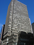
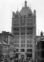
Milk Street is a street in the financial district of Boston, Massachusetts, which was one of Boston's earliest highways. The name "Milk Street" was most likely given to the street in 1708 due to a milk market at the location, although Grace Croft's 1952 work "History and Genealogy of Milk Family" instead proposes that Milk Street may have been named for John Milk, an early shipwright in Boston. The land was originally conveyed to his father, also John Milk, in October 1666. One of the first post offices in Boston was founded on the street in 1711, when the first regular postal routes to Maine, Plymouth and New York were established.

Excerpt from the Wikipedia article Milk Street, Boston (License: CC BY-SA 3.0, Authors, Images).

Milk Street, Boston
Oliver Street, Boston Downtown Boston

Geographical coordinates (GPS) Address Nearby Places
placeShow on map

Wikipedia: Milk Street, BostonContinue reading on Wikipedia

Geographical coordinates (GPS)

Latitude Longitude
N 42.357369444444 ° E -71.054569444444 °
placeShow on map

Address

Two Oliver Street

Oliver Street 2
02110 Boston, Downtown Boston
Massachusetts, United States
mapOpen on Google Maps

2350791007 MilkStreet Boston
Share experience

Nearby Places

Custom House District

Custom House District is a historic district in Boston, Massachusetts, located between the Fitzgerald Expressway (now Purchase St. / the Rose Fitzgerald Kennedy Greenway) and Kilby Street and South Market and High and Batterymarch Streets. Named after the 1849 Boston Custom House located on State Street, the historic district contains about seventy buildings on nearly sixteen acres in Downtown Boston, consisting of 19th-century mercantile buildings along with many early 20th-century skyscrapers, including the 1915 Custom House Tower.The area is an early example of urban planning, in which the Broad Street Associates hired architect Charles Bulfinch in 1805 to plan the commercial development of the area south of Long Wharf and State Street, which connected the wharf to the city center. The district includes a few Federal period buildings that were built to the standards specified by Bulfinch, but is architecturally diverse, reflecting more than century of economic development. Visually prominent 19th-century buildings include a collection of warehouses built out granite, which marked a departure from the more usual brick construction of the period. The State Street Block, built 1858 to a design by Gridley James Fox Bryant, is another example.The district was added to the National Register of Historic Places in 1973. When first listed, its historically significant buildings were limited to those of the 19th century. An amendment to the listing in 1996 extended the period of significance to 1928, changing a number of architecturally significant early skyscrapers from non-contributing to contributing properties.