Maidenhead
Former civil parishes in BerkshireMaidenheadPopulated places on the River ThamesRoyal Borough of Windsor and MaidenheadTowns in Berkshire ... and 2 more
Unparished areas in BerkshireUse British English from September 2013

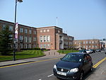
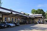
Maidenhead is a market town in the Royal Borough of Windsor and Maidenhead in the county of Berkshire, England, on the southwestern bank of the River Thames. It had an estimated population of 70,374 and forms part of the border with southern Buckinghamshire. The town is situated 27 miles (43 km) west of Charing Cross, London and 13 miles (21 km) east-northeast of the county town of Reading. The town differs from the Parliamentary constituency of Maidenhead, which includes a number of outer suburbs and villages (including parts of Wokingham and Reading) such as Twyford, Charvil, Remenham, Ruscombe and Wargrave.
Excerpt from the Wikipedia article Maidenhead (License: CC BY-SA 3.0, Authors, Images).Maidenhead
St Ives Road,
Geographical coordinates (GPS) Address Nearby Places Show on map
Geographical coordinates (GPS)
| Latitude | Longitude |
|---|---|
| N 51.5217 ° | E -0.7177 ° |
Address
St Ives Road
SL6 1QU , Fishery
England, United Kingdom
Open on Google Maps


