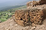
Farradiyya
Arab villages depopulated after the 1948 Arab–Israeli WarDistrict of SafadForcibly depopulated communities of the Israeli–Palestinian conflictPages with non-numeric formatnum argumentsTalmud places

Farradiyya (Arabic: الفرّاضية, al-Farâdhiyyah) was a Palestinian Arab village of 670 located 8 kilometers (5.0 mi) southwest of Safad, A Jewish settlement called 'Farod' was built atop the once ruined village. Farradiyya was situated on the southern slopes of Mount Zabud with an average elevation of 375 meters (1,230 ft) above sea level. The Safad-Nazareth highway (Route 866) passed it to the north. Its total land area was 19,747 dunams, of which 25 dunams were built-up areas and 5,365 dunams cultivable. In 1949, a kibbutz named Parod, after the village's ancient name, was founded nearby.
Excerpt from the Wikipedia article Farradiyya (License: CC BY-SA 3.0, Authors, Images).Farradiyya
Merom HaGalil Regional Council
Geographical coordinates (GPS) Address Nearby Places Show on map
Geographical coordinates (GPS)
| Latitude | Longitude |
|---|---|
| N 32.931666666667 ° | E 35.428333333333 ° |
Address
Merom HaGalil Regional Council
North District, Israel
Open on Google Maps


