place

Shefer

1950 establishments in IsraelMerom HaGalil Regional CouncilMoshavimNorth African-Jewish culture in IsraelPopulated places established in 1950
Populated places in Northern District (Israel)Yemeni-Jewish culture in Israel
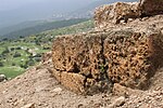
Tegart Fort in Mosav Shefer 2

Shefer (Hebrew: שֶׁפֶר, lit. beauty) is a moshav in northern Israel. Located near Safed, it falls under the jurisdiction of Merom HaGalil Regional Council. In 2021 it had a population of 435.

Excerpt from the Wikipedia article Shefer (License: CC BY-SA 3.0, Authors, Images).

Shefer
HaHaruv, Merom HaGalil Regional Council

Geographical coordinates (GPS) Address Nearby Places
placeShow on map

Wikipedia: SheferContinue reading on Wikipedia

Geographical coordinates (GPS)

Latitude Longitude
N 32.943888888889 ° E 35.436111111111 °
placeShow on map

Address

החרוב

HaHaruv
Merom HaGalil Regional Council
North District, Israel
mapOpen on Google Maps

Tegart Fort in Mosav Shefer 2
Share experience

Nearby Places

Bersabe
Bersabe

Bersabe (Hebrew: בְּאֵר שֶׁבַע, romanized: Bəʾēr Ševaʿ; Ancient Greek: Βηρσαβέ, romanized: Bērsabé, or Βηρσουβαί, Bērsoubaí), also known as Beersheba of Galilee, was a Second Temple period Jewish village located near the town of Kefar Hananya which marked the boundary between the Upper Galilee and the Lower Galilee, as described by Josephus, with Upper Galilee stretching from Bersabe in the Beit HaKerem Valley to Baca (Peki'in) in the north. Bersabe was one of several towns and villages of Galilee fortified by Josephus during the First Jewish–Roman War, being one of the most defensible positions and where insurgents from across Galilee had taken up refuge against the Imperial Roman army when the surrounding countryside was plundered. The ancient village has been identified with the present site of Khirbet es-Saba, a hilltop ruin within a distance of less than a kilometer of the village Kafr 'Inan (Kefr ʿAnan), at the eastern fringe of the Beit HaKerem Valley, and rising some 472 metres (1,549 ft) above sea-level. The same site has been rendered by other authors under the name Khirbet Abu esh-Shebaʿ, a little northwest of Kefr ʿAnan and closely adjoining Farradiyya/Parod to their southwest. The site lies 5 kilometres (3.1 mi) eastward of the Arab town of er-Rameh, along Route 85, and about 8 kilometres (5.0 mi) southwest of Safed. In 1873, Kitchener and Conder, on a surveying mission with the Palestine Exploration Fund, visited the site and mentioned it as being "a large ruin, which stands upon the terraced hill top." A survey later conducted at the site reveal that the village had occupied an area of about 70 dunams (17.3 acres). From a prospect on Mount Kefir in the Mount Meron range, as one looks out over the hilltop ruin of Bersabe, the square layout or lines where once stood the walls of the town can still be distinguished. The line of the ancient wall extended over an area comprising the upper third of the hill. The thickness of the northernmost wall, where the hill was easily accessible, is measured at 2.8 metres (9.2 ft), and was built with three semi-circular watch towers. The easternmost wall was built in a zig-zag configuration. The walls were constructed of fieldstones.

2021 Meron crowd crush

On 30 April 2021, at about 00:45 IDT (UTC+3), a deadly crowd crush occurred on Mount Meron, Israel, during the annual pilgrimage to the tomb of Rabbi Shimon bar Yochai on the Jewish holiday of Lag BaOmer, at which it was estimated that 100,000 people were in attendance. Forty-five men and boys at the event were killed, and about 150 were injured, dozens of them critically, making it the deadliest civil disaster in the history of the State of Israel. The crush occurred after celebrants poured out of one section of the mountainside compound, down a passageway with a sloping metal floor wet with spilled drinks, leading to a staircase continuing down. Witnesses say that people tripped and slipped near the top of the stairs. Those behind, unaware of the blockage ahead, continued. The people further down were trampled over, crushed, and asphyxiated by compression, calling out that they could not breathe. The potential for such a calamity, given the tens of thousands of celebrants, had been reported by the state comptroller and the police chief. The local council had tried several times to close the site. Reuters cited Israeli media outlets in reporting that, as a precaution against the COVID-19 pandemic in the country, bonfire areas had been partitioned off, which may have created unrecognised choke-points. It was later pointed out that the bonfires were not all lit at the same time, as in the past; this allowed people who had seen one lighting go to see another, increasing crowds. On 10 May 2021, police arrested the safety engineer who approved the Lag BaOmer celebration and his assistant. Investigators said that senior police officers should be questioned, as suspects rather than witnesses. On 27 June, Chief Justice of the Supreme Court of Israel, Esther Hayut, announced that a three-paneled state commission of inquiry would be chaired by her predecessor, former Supreme Court Chief Miriam Naor, with the other two members consisting of former Bnei Brak mayor Rabbi Mordechai Karlitz and Aluf (ret.) Shlomo Yanai. In Israel, such a commission of inquiry has the powers to subpoena witnesses and issue recommendations to the government.