place

Roanoke Star

1949 establishments in VirginiaBlue Ridge MountainsBuildings and structures in Roanoke, VirginiaBuildings and structures on the National Register of Historic Places in VirginiaMountains of Roanoke County, Virginia
Mountains of VirginiaNational Register of Historic Places in Roanoke, VirginiaUse mdy dates from August 2023
Roanoke star
Roanoke star

The Roanoke Star, also known as the Mill Mountain Star, is the world's largest freestanding illuminated man-made star. It was constructed at the top of Mill Mountain in Roanoke, Virginia in 1949 by the local merchants association to draw publicity and trade to the city. The star was initially intended to be lit only during Christmas seasons, but was popular enough with the citizens of Roanoke that it is illuminated every night year-round. It stands 88.5 feet (27.0 m) tall and weighs 60,000 pounds (27,000 kg), rests 846 feet (258 m) above the city of Roanoke, and is visible for 60 miles (97 km) from the air. Its 2,000 feet (610 m) of neon tubing are typically lit entirely in white, but have the ability to shine solely in red (historically for tragic events), or in red, white, and blue (for patriotic holidays). The star has become a symbol of Roanoke and the source of its nickname "Star City of the South", and it along with its accompanying scenic overlook are popular tourist destinations in the area.

Excerpt from the Wikipedia article Roanoke Star (License: CC BY-SA 3.0, Authors, Images).

Roanoke Star
Star Trail, Roanoke Morningside

Geographical coordinates (GPS) Address Nearby Places
placeShow on map

Wikipedia: Roanoke StarContinue reading on Wikipedia

Geographical coordinates (GPS)

Latitude Longitude
N 37.250833333333 ° E -79.9325 °
placeShow on map

Address

Star Trail
24014 Roanoke, Morningside
Virginia, United States
mapOpen on Google Maps

Roanoke star
Roanoke star
Share experience

Nearby Places

Roanoke River and Railroad Historic District

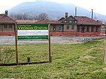
The Roanoke River and Railroad Historic District is a predominantly industrial area on the north side of the Roanoke River in Roanoke, Virginia. The area is bounded by South Jefferson Street on the west and the Roanoke River to the east, and extends north as far as Albemarle Avenue. The district's resources are defined primarily by their relationship to the railroad tracks that bisect this area. The area was developed in the late 19th and early 20th centuries with the completion of the Roanoke & Southern line in 1892 and the Virginian Railway line in 1909, and consists primarily of functional industrial buildings that were built between about 1900 and 1930, an example of which is the Virginia Can Company (built in 1912, listed on the National Register of Historic Places in 2006). Notable exceptions are the Virginian Railway Passenger Station, a Spanish Revival passenger station built 1909-10 and listed on the National Register of Historic Places since 2003, and the Walnut Street and Jefferson Street bridges, completed in 1927 and 1928, respectively. Both bridges were constructed in the Art Deco style and designed with "Egyptian Babylonian" style decorations.Many of the former industrial buildings located in the district have been demolished as part of a city-led redevelopment plan. Sixteen remaining structures contribute to the historic district, which was listed on the National Register of Historic Places in 2013.