place

Virginia Can Company-S.H. Heironimus Warehouse

1912 establishments in VirginiaBuildings and structures in Roanoke, VirginiaIndividually listed contributing properties to historic districts on the National Register in VirginiaIndustrial buildings and structures on the National Register of Historic Places in VirginiaIndustrial buildings completed in 1912
NRHP infobox with nocatNational Register of Historic Places in Roanoke, VirginiaPackaging companies of the United StatesShenandoah Valley, Virginia Registered Historic Place stubsWarehouses on the National Register of Historic Places
Virginia Can Company S.H. Heironimus Warehouse

Virginia Can Company-S.H. Heironimus Warehouse is a historic factory and warehouse complex located at Roanoke, Virginia. The U-shaped complex was built in 1912, and consists of an office and two factory buildings. All three of the buildings are two stories in height and are constructed of brick on a raised foundation of poured concrete. A second-story pedestrian bridge connects the two factory buildings and a brick hyphen connects the office building to the north factory building. The complex was built for the Virginia Can Company, the first and largest manufacturer of tin cans in Roanoke, Virginia. After 1951, it housed a clothing factory and then the Heironimus department store warehouse.It was listed on the National Register of Historic Places in 2006, and included in the Roanoke River and Railroad Historic District in 2013. It is located in the Virginia Landmarks Register listed Southeast Roanoke Historic District.

Excerpt from the Wikipedia article Virginia Can Company-S.H. Heironimus Warehouse (License: CC BY-SA 3.0, Authors, Images).

Virginia Can Company-S.H. Heironimus Warehouse
Mill Mountain Greenway, Roanoke Morningside

Geographical coordinates (GPS) Address Phone number Website Nearby Places
placeShow on map

Wikipedia: Virginia Can Company-S.H. Heironimus WarehouseContinue reading on Wikipedia

Geographical coordinates (GPS)

Latitude Longitude
N 37.265 ° E -79.938333333333 °
placeShow on map

Address

Carilion Roanoke Community Hospital

Mill Mountain Greenway 101
24013 Roanoke, Morningside
Virginia, United States
mapOpen on Google Maps

Phone number
Carilion Clinic

call+15409858000

Website
carilionclinic.org

linkVisit website

Virginia Can Company S.H. Heironimus Warehouse
Share experience

Nearby Places

Boxley Building
Boxley Building

The Boxley Building is a historic commercial building located in Roanoke, Virginia. It was built in 1922, during a wave of post-World War I construction in the city. The building is eight stories, and follows a pattern set by other skyscrapers of the time in consisting of three sections similar to a classical column. The bottom section, or pedestal, is one story fronted with granite; the middle section, or shaft, consists of the next six stories built with beige enameled brick; the top section, or capital, is the eighth story fronted with richly decorated terra cotta panels topped with a finely detailed copper cornice.The building was commissioned by William Wise Boxley, a local builder and developer who was Roanoke's mayor at the time of construction. Boxley was an influential figure in the city, having played a significant role in the founding of the Shenandoah Life Insurance Company and Colonial American Bank as well as sitting on the boards of both Roanoke College and Virginia Military Institute. Boxley was elected to the Roanoke City Council in 1918, and the following year was appointed the city's first mayor under its new council-manager form of government.: 552  The building's architect was Edward G. Frye, whose firm had previously erected the Roanoke Times building, the city's municipal building, and would complete Roanoke's new market building in the same year as the Boxley.: 500, 504, 586 Boxley's building materials company was one of the original tenants of the building, and remained headquartered there until vacating in 2005. The building was empty from the late-2000s until being purchased by a local developer in 2016. The building's offices were converted into residential space, with the bottom four floors used as dormitory housing for international students of two Roanoke-area parochial schools, and the top four floors converted into luxury apartments.The building was listed on the National Register of Historic Places in 1984, and it is a contributing structure to the Roanoke Downtown Historic District.

Roanoke City Market Historic District

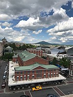
Roanoke City Market Historic District, also known as City Market District, is a national historic district located in the Downtown Roanoke area of Roanoke, Virginia. The district's history dates to 1882, when the Norfok and Western Railway (N&W) began the process of locating its headquarters to the small town of Big Lick. That decision precipitated a name change for the town to Roanoke, as well as a migration of the town's business district southeast towards the new railroad depot and hotel being built by the N&W. A town square along Campbell Avenue began seeing use as a makeshift open-air market, and in 1884 the new City of Roanoke's original charter provided for the construction of a municipal market. Completed in 1886, the original market building occupied the northwestern portion of the square; when that building was destroyed by fire it was replaced in 1922 with the current building and its centered arrangement.It was listed on the National Register of Historic Places in 1983, with an area roughly bounded by Williamson Rd., Norfolk Ave., S. Jefferson St., and Church Ave. The district area was increased to include 302 Campbell Ave., SE, and 9 Church Ave, SE, in 2002. The district encompasses 51 contributing buildings and 1 contributing object. The focal point of the area's grid-plan is the City Market Building (1922) set in the middle of the central Market Square. Other notable buildings include the Hartsook Building (1897), Lampros Building (1909), the McGuire Building (1914), and the Goria Brothers Grocery Building (1924). Located in the district is the separately listed Fire Station No. 1.

Roanoke River and Railroad Historic District

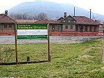
The Roanoke River and Railroad Historic District is a predominantly industrial area on the north side of the Roanoke River in Roanoke, Virginia. The area is bounded by South Jefferson Street on the west and the Roanoke River to the east, and extends north as far as Albemarle Avenue. The district's resources are defined primarily by their relationship to the railroad tracks that bisect this area. The area was developed in the late 19th and early 20th centuries with the completion of the Roanoke & Southern line in 1892 and the Virginian Railway line in 1909, and consists primarily of functional industrial buildings that were built between about 1900 and 1930, an example of which is the Virginia Can Company (built in 1912, listed on the National Register of Historic Places in 2006). Notable exceptions are the Virginian Railway Passenger Station, a Spanish Revival passenger station built 1909-10 and listed on the National Register of Historic Places since 2003, and the Walnut Street and Jefferson Street bridges, completed in 1927 and 1928, respectively. Both bridges were constructed in the Art Deco style and designed with "Egyptian Babylonian" style decorations.Many of the former industrial buildings located in the district have been demolished as part of a city-led redevelopment plan. Sixteen remaining structures contribute to the historic district, which was listed on the National Register of Historic Places in 2013.