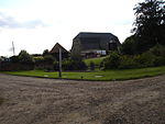
Shalford, Essex
Braintree DistrictCivil parishes in EssexEssex geography stubsUse British English from February 2018Villages in Essex

Shalford is a village and civil parish in the Braintree district of Essex, England. The village is approximately 4 miles (6 km) north from Braintree on the B1057 road. The parish includes the hamlets of Church End, Jasper's Green, and Shalford Green. The village has a primary school, a village hall, and a 14th-century pub (The George). At the southern end of the village is Stoneley Park, constructed in 1997 from an infilled sand pit and where trees were planted by local residents. The Tour de France cycle race passed through Shalford on the third and final day of its visit to England, on Monday 7 July 2014, en route from Cambridge to London.
Excerpt from the Wikipedia article Shalford, Essex (License: CC BY-SA 3.0, Authors, Images).Shalford, Essex
The Street, Essex
Geographical coordinates (GPS) Address Nearby Places Show on map
Geographical coordinates (GPS)
| Latitude | Longitude |
|---|---|
| N 51.935 ° | E 0.503 ° |
Address
The Street
The Street
CM7 5HN Essex, Shalford
England, United Kingdom
Open on Google Maps


