Oxclose
AC with 0 elementsPopulated places in Tyne and WearTyne and Wear geography stubsWashington, Tyne and Wear

Oxclose is an area of Washington, Tyne and Wear, England. It is located between the A1231, A182 and A195 highways, close to Sunderland, and is well served by links from the A1(M) which passes within 1 mile (1.6 km) of Oxclose's boundaries. Oxclose covers an area of approximately 0.1 square miles (300,000 m2) and has a population of around 3800 (2001 Census). There are two churches, a 'Multi-Purpose' Centre and a village centre which contains a shop, newsagents, fish and chip shop and a local pub called The Ox and Plough. It is also near to the Galleries Shopping Centre.
Excerpt from the Wikipedia article Oxclose (License: CC BY-SA 3.0, Authors, Images).Oxclose
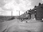
Dilston Close, Sunderland Oxclose
Geographical coordinates (GPS) Address Phone number Website Nearby Places Show on map
Geographical coordinates (GPS)
| Latitude | Longitude |
|---|---|
| N 54.897222222222 ° | E -1.545 ° |
Address
Oxclose Community Academy
Dilston Close
NE38 0LN Sunderland, Oxclose
England, United Kingdom
Open on Google Maps


