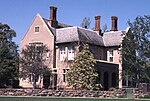
Lower North East Road
Lower North East Road is an arterial road in the northeastern suburbs of Adelaide, South Australia. From west to east, it consists of North Terrace through Kent Town, Payneham Road and Lower North East Road proper. It links the north-eastern corner of Adelaide to Houghton in the Adelaide Hills, and is an urban alternative to North East Road. Payneham Road runs from the northern end of Fullarton Road across Portrush Road to Glynburn Road at Glynde, South Australia, and continues as Lower North East Road to Hope Valley, where it meets the aastern Terminus of Grand Junction Road. It continues up a ridge of the Adelaide Hills through Houghton and meets North East Road. Payneham and Lower North East Roads are initially on the south side of the River Torrens, mirrored by North East Road on the northern side.
Excerpt from the Wikipedia article Lower North East Road (License: CC BY-SA 3.0, Authors).Lower North East Road
Dequetteville Terrace, Adelaide Kent Town
Geographical coordinates (GPS) Address Nearby Places Show on map
Geographical coordinates (GPS)
| Latitude | Longitude |
|---|---|
| N -34.9196 ° | E 138.6151 ° |
Address
Dequetteville Terrace
Dequetteville Terrace
5067 Adelaide, Kent Town
South Australia, Australia
Open on Google Maps


