place

Usonia Historic District

Frank Lloyd Wright buildingsHistoric districts in Westchester County, New YorkHistoric districts on the National Register of Historic Places in New York (state)Houses in Westchester County, New YorkModernist architecture in New York (state)
Mount Pleasant, New YorkNRHP infobox with nocatNational Register of Historic Places in Westchester County, New YorkNew York (state) building and structure stubsWestchester County, New York Registered Historic Place stubs
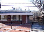
Sol Friedman House 01

Usonia Historic District was a planned community and is now a national historic district located in Town of Mount Pleasant, adjacent to the village of Pleasantville, Westchester County, New York. In 1945, a 100-acre (0.40 km2) rural tract was purchased by a cooperative of young couples from New York City, who were able to enlist Frank Lloyd Wright to build his Broadacre City concept. Wright decided where each house should be placed. Wright designed three homes himself and approved architectural plans of the other 44, which were designed by such architects as Paul Schweikher, Theodore Dixon Bower, Ulrich Franzen, Kaneji Domoto, Aaron Resnick and David Henken – an engineer and Wright apprentice.The layout of the neighborhood was planned by Wright in a circular manner, preserving most of the original trees and "encouraging the flow of the land". The balance of the homes were decreed to be in the modern "organic" style ordained by Wright. The community was named "Usonia" in homage to Wright, whose ideas on the way Americans should live together guided their plan. It was listed on the National Register of Historic Places in 2012 as the Usonia Historic District. The historic district encompasses 43 contributing buildings, 1 contributing site, and 3 contributing structures.The Frank Lloyd Wright-designed Usonian homes in Pleasantville are:

Excerpt from the Wikipedia article Usonia Historic District (License: CC BY-SA 3.0, Authors, Images).

Usonia Historic District
Usonia Road,

Geographical coordinates (GPS) Address Nearby Places
placeShow on map

Wikipedia: Usonia Historic DistrictContinue reading on Wikipedia

Geographical coordinates (GPS)

Latitude Longitude
N 41.128333333333 ° E -73.748888888889 °
placeShow on map

Address

Usonia Road 19
10570
New York, United States
mapOpen on Google Maps

Sol Friedman House 01
Share experience

Nearby Places

Westchester County, New York

Westchester County is located in the U.S. state of New York. It is the seventh most populous county in the State of New York and the most populous north of New York City. According to the 2020 United States Census, the county had a population of 1,004,456, its highest decennial count ever and an increase of 55,344 (5.8%) from the 949,113 counted in 2010. Located in the Hudson Valley, Westchester covers an area of 450 square miles (1,200 km2), consisting of six cities, 19 towns, and 23 villages. Established in 1683, Westchester was named after the city of Chester, England. The county seat is the city of White Plains, while the most populous municipality in the county is the city of Yonkers, with 211,569 residents per the 2020 U.S. Census. The annual per capita income for Westchester was $67,813 in 2011. The 2011 median household income of $77,006 was the fifth-highest in New York (after Nassau, Putnam, Suffolk, and Rockland counties) and the 47th highest in the United States. By 2021, the county's median household income had risen to $105,387. Westchester County ranks second in the state after New York County for median income per person, with a higher concentration of incomes in smaller households. Simultaneously, Westchester County had the highest property taxes of any county in the United States in 2013.Westchester County is one of the centrally located counties within the New York metropolitan area. The county is positioned with New York City, plus Nassau and Suffolk counties (on Long Island, across Long Island Sound), to its south; Putnam County to its north; Fairfield County, Connecticut, to its east; and Rockland County and Bergen County, New Jersey, across the Hudson River to the west. Westchester was the first suburban area of its scale in the world to develop, due mostly to the upper-middle-class development of entire communities in the late 19th century and the subsequent rapid population growth.Westchester County has numerous road and mass transit connections to New York City, and the county is home to the headquarters of large multinational corporations including IBM, Mastercard, PepsiCo, and Regeneron Pharmaceuticals. Westchester County high school students often feature prominently as winners of the International Science and Engineering Fair and similar STEM-based academic awards.