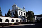
Czersk, Masovian Voivodeship

Czersk (Polish pronunciation: [t͡ʂɛrsk] ) is a settlement in the administrative district of Gmina Góra Kalwaria, within Piaseczno County, Masovian Voivodeship, in east-central Poland. It lies approximately 2 kilometres (1 mi) south-east of Góra Kalwaria, 19 km (12 mi) south-east of Piaseczno, and 33 km (21 mi) south-east of Warsaw. The village also lies on the Czersk Lake (size: 9 hectares), which is an oxbow lake of the Vistula. Czersk was an important settlement in the past and is one of the oldest Mazovian cities, famous for ruins of a medieval castle constructed in the late 14th century. It was a royal town of the Crown of the Kingdom of Poland in the past. In 1247–1526, it was the capital of the Duchy of Czersk, one of medieval Polish duchies. After incorporation of Mazovia into Poland (1526), the duchy was turned into the Czersk Land (see ziemia), part of Masovian Voivodeship (1526–1795). The Land of Czersk was divided into four counties - those of Czersk, Grójec, Garwolin (since 1539), and Warka. Czersk itself was the seat of castellans, who also were senators of the Polish–Lithuanian Commonwealth.
Excerpt from the Wikipedia article Czersk, Masovian Voivodeship (License: CC BY-SA 3.0, Authors, Images).Czersk, Masovian Voivodeship
Warecka, gmina Góra Kalwaria
Geographical coordinates (GPS) Address Nearby Places Show on map
Geographical coordinates (GPS)
| Latitude | Longitude |
|---|---|
| N 51.958611111111 ° | E 21.230277777778 ° |
Address
Warecka
gmina Góra Kalwaria
Masovian Voivodeship, Poland
Open on Google Maps


