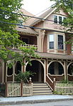
Cambridgeport, Cambridge, Massachusetts
Middlesex County, Massachusetts geography stubsNeighborhoods in Cambridge, MassachusettsWarehouse districts of the United States

Cambridgeport is one of the neighborhoods of Cambridge, Massachusetts. It is bounded by Massachusetts Avenue, the Charles River, the Grand Junction Railroad, and River Street. The neighborhood contains predominantly residential homes, many of the triple decker style common in New England. Central Square, at the northernmost part of Cambridgeport, is an active commercial district and transportation hub, and University Park is a collection of renovated or recently constructed office and apartment buildings. The neighborhood also includes Fort Washington Park, several MIT buildings, and Magazine Beach. The neighborhood is Area 5 of Cambridge.
Excerpt from the Wikipedia article Cambridgeport, Cambridge, Massachusetts (License: CC BY-SA 3.0, Authors, Images).Cambridgeport, Cambridge, Massachusetts
Erie Street, Cambridge Cambridgeport
Geographical coordinates (GPS) Address Nearby Places Show on map
Geographical coordinates (GPS)
| Latitude | Longitude |
|---|---|
| N 42.36 ° | E -71.1075 ° |
Address
Erie Street 181
02139 Cambridge, Cambridgeport
Massachusetts, United States
Open on Google Maps


