Hochwang
Graubünden geography stubsMountains of GraubündenMountains of SwitzerlandMountains of the AlpsTwo-thousanders of Switzerland

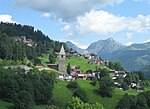
The Hochwang is a mountain of the Plessur Alps, located between the valleys of Schanfigg and Prättigau in the canton of Graubünden. With a height of 2,534 metres above sea level, it is the highest summit of the chain lying west of Durannapass. Several trails lead to its summit. The closest locality is Castiel.
Excerpt from the Wikipedia article Hochwang (License: CC BY-SA 3.0, Authors, Images).Hochwang
Bergweg,
Geographical coordinates (GPS) Address Nearby Places Show on map
Geographical coordinates (GPS)
| Latitude | Longitude |
|---|---|
| N 46.874194444444 ° | E 9.6328611111111 ° |
Address
Bergweg
7028
Grisons, Switzerland
Open on Google Maps


