place

Buildwas Abbey

1135 establishments in England1536 disestablishments in EnglandChristian monasteries established in the 12th centuryCistercian monasteries in EnglandEnglish Heritage sites in Shropshire
Geographic coordinate listsGrade I listed buildings in ShropshireGrade I listed monasteriesIronbridge GorgeLists of coordinatesMonasteries dissolved under the English ReformationMonasteries in ShropshireOpenDomesdayReligious organizations established in the 1130sRiver SevernRuins in ShropshireUse British English from January 2017
BuildwasAbbey
BuildwasAbbey

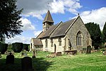
Buildwas Abbey was a Cistercian (originally Savigniac) monastery located on the banks of the River Severn, at Buildwas in Shropshire, England - today about 2 miles (3.2 km) west of Ironbridge. Founded by the local bishop in 1135, it was sparsely endowed at the outset but enjoyed several periods of growth and increasing wealth: notably under Abbot Ranulf in the second half of the 12th century and again from the mid-13th century, when large numbers of acquisitions were made from the local landed gentry. Abbots were regularly used as agents by Plantagenet in their attempts to subdue Ireland and Wales and the abbey acquired a daughter house in each country. It was a centre of learning, with a substantial library, and was noted for its discipline until the economic and demographic crises of the 14th century brought about decline and difficulties, exacerbated by conflict and political instability in the Welsh Marches. The abbey was suppressed in 1536 as part of the Dissolution of the Monasteries under Henry VIII. Substantial remains of the abbey church and monks' quarters remain and are in the care of English Heritage.

Excerpt from the Wikipedia article Buildwas Abbey (License: CC BY-SA 3.0, Authors, Images).

Buildwas Abbey
Buildwas Road,

Geographical coordinates (GPS) Address Nearby Places
placeShow on map

Wikipedia: Buildwas AbbeyContinue reading on Wikipedia

Geographical coordinates (GPS)

Latitude Longitude
N 52.6354 ° E -2.5284 °
placeShow on map

Address

Buildwas Road
TF8 7BX , Buildwas
England, United Kingdom
mapOpen on Google Maps

BuildwasAbbey
BuildwasAbbey
Share experience

Nearby Places

Buildwas railway station

Buildwas railway station was an isolated junction railway station on the Wellington to Craven Arms Railway and Severn Valley Railway. Opened on 1 February 1862. Although the station served both the Severn Valley Railway and Wellington to Craven Arms Railway, it was an interchange station in open countryside with no passenger access except by rail.The station had three platforms, with two platforms at a lower level serving the Severn Valley Railway and one at a higher level serving the Wellington to Craven Arms Railway. At its peak, the station had a total of eleven staff, including the station master. Up to 1923 the area was controlled by two signal boxes, the Station signal box controlling the station area and the Junction signal box controlling the junction between the Severn Valley line and the double track line across the Albert Edward Bridge towards Lightmoor Junction. These were replaced with a single signal box approximately midway between its predecessors in 1923. This box was subsequently enlarged to accommodate a frame containing 113 levers on 9 December 1931. The track layout was altered several times during its existence including the additional CEGB sidings opened in 1932.The planned closure of the northern end of the Severn Valley Line including Buildwas station pre-dated the Beeching report. Following closure, the station was demolished to make way for Ironbridge B Power Station. Coal for the power station was offloaded close to the site of the original station until the power station stopped generating electricity in November 2015.The Telford Steam Railway has aspirations to operate to this site, running over the Albert Edward Bridge to a new terminus on or close to the site of Buildwas station.

Little Wenlock
Little Wenlock

Little Wenlock is a village and civil parish in the Telford and Wrekin borough in Shropshire, England. The population of the civil parish at the 2011 census was 605. It was mentioned in the Domesday Book, when it belonged to Wenlock Priory. Ancient habitation is attested by the discovery of two caches of Bronze Age weapons. The village is situated two miles west of Dawley. Nearby is the 1335-foot-high Wrekin, one of Shropshire's famous hills with an ancient hill fort. Part of it falls within Little Wenlock parish, while the adjoining parts fall into other parishes. The name "Wenlock" as found in Much Wenlock and Little Wenlock (and also Great Wenlock, a now obsolete name, but found in some historic sources) is probably derived from the Old English *Wenan loca meaning "Wena's Stronghold" (wéna being feminine and meaning "hope") The town was recorded in the Domesday Book as Wenloch. The "Little" of the name distinguishes it from the larger settlement and market town of Much Wenlock, which is situated several miles to the south, on the other side of the River Severn. 11-year-old Alice Glaston from Little Wenlock was hanged together with two men in Much Wenlock on 13 April 1546, for an unknown crime. She is the youngest known girl legally executed in Great Britain. The village features a public house (the "Huntsman Inn"), village hall, playing field and the Church of England parish church of St Lawrence. David Cranage, later Dean of Norwich, was curate at the church in 1897-98.For many years there was small scale mining in the parish, for coal, limestone and fire clay.