place

Little Wenlock

Civil parishes in ShropshireTelford and WrekinVillages in Shropshire
Old Quarry Plantation and Little Wenlock geograph.org.uk 2069988

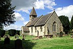
Little Wenlock is a village and civil parish in the Telford and Wrekin borough in Shropshire, England. The population of the civil parish at the 2011 census was 605. It was mentioned in the Domesday Book, when it belonged to Wenlock Priory. Ancient habitation is attested by the discovery of two caches of Bronze Age weapons. The village is situated two miles west of Dawley. Nearby is the 1335-foot-high Wrekin, one of Shropshire's famous hills with an ancient hill fort. Part of it falls within Little Wenlock parish, while the adjoining parts fall into other parishes. The name "Wenlock" as found in Much Wenlock and Little Wenlock (and also Great Wenlock, a now obsolete name, but found in some historic sources) is probably derived from the Old English *Wenan loca meaning "Wena's Stronghold" (wéna being feminine and meaning "hope") The town was recorded in the Domesday Book as Wenloch. The "Little" of the name distinguishes it from the larger settlement and market town of Much Wenlock, which is situated several miles to the south, on the other side of the River Severn. 11-year-old Alice Glaston from Little Wenlock was hanged together with two men in Much Wenlock on 13 April 1546, for an unknown crime. She is the youngest known girl legally executed in Great Britain. The village features a public house (the "Huntsman Inn"), village hall, playing field and the Church of England parish church of St Lawrence. David Cranage, later Dean of Norwich, was curate at the church in 1897-98.For many years there was small scale mining in the parish, for coal, limestone and fire clay.

Excerpt from the Wikipedia article Little Wenlock (License: CC BY-SA 3.0, Authors, Images).

Little Wenlock
Witchwell Lane,

Geographical coordinates (GPS) Address Nearby Places
placeShow on map

Wikipedia: Little WenlockContinue reading on Wikipedia

Geographical coordinates (GPS)

Latitude Longitude
N 52.658 ° E -2.524 °
placeShow on map

Address

Witchwell Lane

Witchwell Lane
TF6 5BQ
England, United Kingdom
mapOpen on Google Maps

Old Quarry Plantation and Little Wenlock geograph.org.uk 2069988
Share experience

Nearby Places

Uriconian

Uriconian rocks are volcanic rocks found in parts of Shropshire, United Kingdom. The name relates to Uriconio, the Latin name for an Iron Age hillfort on the summit of the Wrekin, a hill formed of Uriconian rock. The Uriconian rocks of Shropshire (Wrekin Terrane) are thought to be potentially related to the Longmyndian Supergroup of the Stretton Hills, Shropshire, United Kingdom. Current geological profiling of the terranes suggests that the Uriconian rocks are of Precambrian age (Neoproterozoic Phases 2 and 3). The Uriconian Rocks outcrop to the southeast of the Long Mynd area of the Welsh Borderland Fault System and beyond the Church Stretton Fault which trends northeast-southwest across the area. The Stretton Hills are composed primarily of arenaceous (quartz rich sand) beds assigned to the Longmyndian Supergroup. The Longmyndian rocks are a c.6 km thick group of volcaniclastic and bentonitic sediment horizons. The Uriconian have long thought to be older than the Longmyndian and generally outcrop to the southeast of the latter within northeast-southwest trending lineaments suggesting basement influence for the regional structure.The Uriconian rocks outcrop in areas from Wellington, Shropshire to Primrose Hill on the southwest side of The Wrekin, east of Caer Caradoc and in the Craven Arms Inlier. Primarily the strata exist as fault-bounded slices within splays of, and to the southeast of, the main Church Stretton fault system. The Uriconian rocks comprise both intermediate to acidic and basic (bimodal) volcanic suites that reflect largely intraplate origins for the complex although some subduction signatures have been identified. Further work has led to suggest that the locality of this kind of volcanism is related to marginal basin volcanicity (behind the main arc) influenced by trans-tension brought about by oblique subduction.The Neoproterozoic sediments were deposited on Avalonia in various strike-slip faulted basins and they comprise predominantly volcaniclastic and siliciclastic sediments.

Buildwas railway station

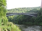
Buildwas railway station was an isolated junction railway station on the Wellington to Craven Arms Railway and Severn Valley Railway. Opened on 1 February 1862. Although the station served both the Severn Valley Railway and Wellington to Craven Arms Railway, it was an interchange station in open countryside with no passenger access except by rail.The station had three platforms, with two platforms at a lower level serving the Severn Valley Railway and one at a higher level serving the Wellington to Craven Arms Railway. At its peak, the station had a total of eleven staff, including the station master. Up to 1923 the area was controlled by two signal boxes, the Station signal box controlling the station area and the Junction signal box controlling the junction between the Severn Valley line and the double track line across the Albert Edward Bridge towards Lightmoor Junction. These were replaced with a single signal box approximately midway between its predecessors in 1923. This box was subsequently enlarged to accommodate a frame containing 113 levers on 9 December 1931. The track layout was altered several times during its existence including the additional CEGB sidings opened in 1932.The planned closure of the northern end of the Severn Valley Line including Buildwas station pre-dated the Beeching report. Following closure, the station was demolished to make way for Ironbridge B Power Station. Coal for the power station was offloaded close to the site of the original station until the power station stopped generating electricity in November 2015.The Telford Steam Railway has aspirations to operate to this site, running over the Albert Edward Bridge to a new terminus on or close to the site of Buildwas station.