Olterterp
Friesland geography stubsGeography of OpsterlandPopulated places in Friesland

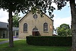
Olterterp is a village in the municipality of Opsterland in the east of Friesland, the Netherlands. It had a population of around 75 in January 2017.The village was first mentioned in 1505 as Otterterp, and means "outer settlement". The Dutch Reformed church was built in 1414 or 1415 as a replacement of an earlier church. The church was built without a tower. The tower was added in 1744.Olterterp was home to 154 people in 1840. Most of the land was owned by Ambrosius Ayso van Boelens. Around 1850, van Boelens started to cultivate the wilderness and turn it into farmland.
Excerpt from the Wikipedia article Olterterp (License: CC BY-SA 3.0, Authors, Images).Olterterp
Van Harinxmaweg, Opsterland
Geographical coordinates (GPS) Address Nearby Places Show on map
Geographical coordinates (GPS)
| Latitude | Longitude |
|---|---|
| N 53.066388888889 ° | E 6.1036111111111 ° |
Address
Van Harinxmaweg 20
9246 TL Opsterland
Frisia, Netherlands
Open on Google Maps


