Hemrik
Friesland geography stubsGeography of OpsterlandPopulated places in Friesland

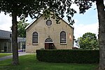
Hemrik (West Frisian: De Himrik) is a village in the municipality of Opsterland in the east of Friesland, the Netherlands. It had a population of around 770 in January 2017.The village was first mentioned in 1315 as Hemericke, and means village area. Hemrik developed on a sandy ridge in a heath and moorland region. Around 1750, the Opsterlandse Compagnonsvaart was dug for the excavation of peat. A chapel existed in the village as early as 1315. The Dutch Reformed church dates from 1739, and is colloquially called White Church due its white plaster.Hemrik was home to 352 people in 1840.
Excerpt from the Wikipedia article Hemrik (License: CC BY-SA 3.0, Authors, Images).Hemrik
Andryssingel, Opsterland
Geographical coordinates (GPS) Address Nearby Places Show on map
Geographical coordinates (GPS)
| Latitude | Longitude |
|---|---|
| N 53.030833333333 ° | E 6.1380555555556 ° |
Address
Andryssingel 23
8409 JD Opsterland
Frisia, Netherlands
Open on Google Maps


