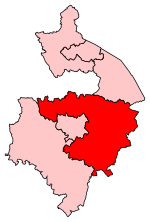
Ufton
Civil parishes in WarwickshireStratford-on-Avon DistrictVillages in Warwickshire

Ufton is a small village and civil parish in the Stratford-on-Avon District of Warwickshire, England. The population taken from the 2011 census was 319. It is 5 miles (8 km) south east of Royal Leamington Spa and 2 miles (3 km) west of Southam on the A425 road. It sits on top of a glacial escarpment 121 metres above sea level, which was formed during the last ice age. Ufton Fields, a 77-acre (31 ha) Site of Special Scientific Interest, is to the south east of the village. The parish church, which is dedicated to St Michael, dates back at least to the start of the 13th century. The Grand Union Canal is within walking distance of the village to the north.
Excerpt from the Wikipedia article Ufton (License: CC BY-SA 3.0, Authors, Images).Ufton
B4452, Stratford-on-Avon Ufton CP
Geographical coordinates (GPS) Address Nearby Places Show on map
Geographical coordinates (GPS)
| Latitude | Longitude |
|---|---|
| N 52.25 ° | E -1.4333333333333 ° |
Address
B4452
CV33 9NX Stratford-on-Avon, Ufton CP
England, United Kingdom
Open on Google Maps


