Charles River Dam Bridge
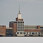
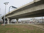
The Charles River Dam Bridge, officially the Craigie Bridge, also called Craigie's Bridge or the Canal Bridge, is a six-lane bascule bridge across the Charles River in the West End neighborhood of Boston. The bridge, maintained by the Massachusetts Department of Conservation and Recreation (DCR, formerly the MDC), carries Massachusetts Route 28 (Charles River Dam Road at this location) next to the Green Line's Lechmere Viaduct. The Museum of Science is located on the dam and nearby piers. Charles River Dam Road connects Leverett Circle in the West End to East Cambridge, but most of the road is fixed, and the asymmetrically sited drawbridge is a short span entirely on the Boston side of the river.The original lock for the Charles River was incorporated into the dam, just west of the Charles River Dam Bridge, but it was replaced by three parallel locks in the new Charles River Dam, located further east, at the site of the old Warren Bridge. The former lock at the Charles River Dam Bridge now allows water and small ships to flow freely. Taller ships require the opening of the drawbridge, operated by the Massachusetts Department of Transportation.
Excerpt from the Wikipedia article Charles River Dam Bridge (License: CC BY-SA 3.0, Authors).Charles River Dam Bridge
Industrial Park Road, Cambridge
Geographical coordinates (GPS) Address Nearby Places Show on map
Geographical coordinates (GPS)
| Latitude | Longitude |
|---|---|
| N 42.368 ° | E -71.0708 ° |
Address
O'Brien Hwy opp Museum of Science
Industrial Park Road
02214 Cambridge
Massachusetts, United States
Open on Google Maps


