White House Bridge
Road bridges in VirginiaSouthern United States bridge (structure) stubsVirginia building and structure stubsVirginia transportation stubsWooden bridges in the United States
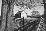
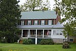
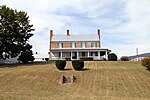
White House Bridge was located west of Luray, Virginia over the South Fork of the Shenandoah River. During the American Civil War, on 2 June 1862, Stonewall Jackson's cavalry chief Turner Ashby burned this bridge to slow down Federal pursuit of their forces. The battles of Cross Keys and Port Republic were fought a week later. Earlier that year, during April union cavalry had stopped Confederate forces from destroying the bridge.
Excerpt from the Wikipedia article White House Bridge (License: CC BY-SA 3.0, Authors).White House Bridge
Kaufmans Mill Road,
Geographical coordinates (GPS) Address Nearby Places Show on map
Geographical coordinates (GPS)
| Latitude | Longitude |
|---|---|
| N 38.646209 ° | E -78.535745 ° |
Address
Kaufmans Mill Road 1866
22835
Virginia, United States
Open on Google Maps


