RAF Angle

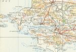
Royal Air Force Angle or more commonly RAF Angle, is a former Royal Air Force station located on the Angle Peninsula Coast, 8 miles (13 km) west of Pembroke, Pembrokeshire, Wales. It was operational from 1 June 1941 to 11 July 1946, having been used by both the Royal Air Force and the Royal Navy. The village of Angle is 0.5 miles (0.80 km) north of the airfield, which is located along the coast. Notable landmarks are, Freshwater West beach to the south of the airfield, and the St. Gowans lightship, 8 miles (13 km) south of Linney Head. The airfield opened as a RAF Fighter Command forward airfield, within No. 10 Group RAF as part of the Fairwood Common Sector. During the previous year the Luftwaffe had attacked Pembroke Docks and Milford Haven with the freedom from any consequences of air defences, causing a furore at high levels of state, and highlighting the need for anti-aircraft operations for the whole of the area.
Excerpt from the Wikipedia article RAF Angle (License: CC BY-SA 3.0, Authors, Images).RAF Angle
Angle Road,
Geographical coordinates (GPS) Address Nearby Places Show on map
Geographical coordinates (GPS)
| Latitude | Longitude |
|---|---|
| N 51.674444444444 ° | E -5.0983333333333 ° |
Address
Angle Road
Angle Road
SA71 5BA , Angle
Wales, United Kingdom
Open on Google Maps


