Thorne Island
EngvarB from May 2018History of PembrokeshireIslands of Pembrokeshire

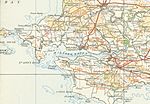
Thorne Island is a rocky islet and part of the community of Angle, Pembrokeshire, Wales, with an area of 2 acres (8,100 m2), dominated by a coastal artillery fort built to defend the Milford Haven Waterway in the mid-19th century. It has been the site of a number of shipwrecks, including one in 1894 that was carrying a cargo of Scotch whisky.
Excerpt from the Wikipedia article Thorne Island (License: CC BY-SA 3.0, Authors, Images).Thorne Island
West Bay Close,
Geographical coordinates (GPS) Address External links Nearby Places Show on map
Geographical coordinates (GPS)
| Latitude | Longitude |
|---|---|
| N 51.691822 ° | E -5.118136 ° |
Address
Thorn Island Fort
West Bay Close
SA71 5AW , Angle
Wales, United Kingdom
Open on Google Maps


