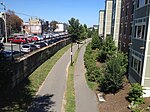
Noddle's Island

Noddle's Island was historically one of the Boston Harbor Islands off Boston, Massachusetts. Most of the original land of Noddle's Island now makes up the southern part of the neighborhood of East Boston; it is now part of the mainland since the strait connecting Noddle's Island to Hog Island and that connecting Hog Island to the mainland city of Revere were filled in the early 20th century. The original contours of Noddle's Island were also greatly obscured by the 20th-century construction of Logan International Airport, which filled the tidal flats between Noddle's Island and Governor's, Bird, and Apple islands to its east. In some sources it is spelled "Noodle's Island".
Excerpt from the Wikipedia article Noddle's Island (License: CC BY-SA 3.0, Authors, Images).Noddle's Island
Brooks Street, Boston East Boston
Geographical coordinates (GPS) Address Nearby Places Show on map
Geographical coordinates (GPS)
| Latitude | Longitude |
|---|---|
| N 42.379 ° | E -71.035 ° |
Address
Brooks Street 151
02128 Boston, East Boston
Massachusetts, United States
Open on Google Maps


