Hallow, Worcestershire
AC with 0 elementsVillages in Worcestershire

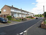
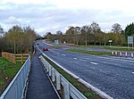
Hallow is a village and civil parish beside the River Severn, about 2 miles (3.2 km) north-west of Worcester in Worcestershire. The village is on the A443 road that links Worcester with Holt Heath. Hallow has a public house, a post office and a Church of England primary school.Following the Poor Law Amendment Act 1834 Grimley Parish, of which Hallow was then part, ceased to be responsible for maintaining the poor in its parish. This responsibility was transferred to Martley Poor Law Union.
Excerpt from the Wikipedia article Hallow, Worcestershire (License: CC BY-SA 3.0, Authors, Images).Hallow, Worcestershire
Church Lane, Malvern Hills District
Geographical coordinates (GPS) Address Nearby Places Show on map
Geographical coordinates (GPS)
| Latitude | Longitude |
|---|---|
| N 52.221 ° | E -2.253 ° |
Address
Church Lane
Church Lane
WR2 6PE Malvern Hills District
England, United Kingdom
Open on Google Maps


