Argyle Street, Hong Kong

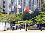
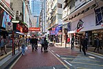
Argyle Street is a four-lane dual-way thoroughfare in Kowloon, Hong Kong, connecting the districts of Mong Kok, Ho Man Tin, Ma Tau Wai and Kowloon City. It runs on an east-west alignment starting at its intersection with Cherry Street, Ferry Street and Tong Mi Road in the west, and ending near the former Kai Tak Airport in the east. Due to the street's proximity with the latter, a variety of aircraft could be seen from this street and thus photographers (and movie makers) seized the opportunity to capture landing aircraft. The street was named after a British merchant ship called Argyle, which sailed between India and southern China in the early 19th Century.
Excerpt from the Wikipedia article Argyle Street, Hong Kong (License: CC BY-SA 3.0, Authors, Images).Argyle Street, Hong Kong
Argyle Street, Kowloon Ho Man Tin (Kowloon City District)
Geographical coordinates (GPS) Address Nearby Places Show on map
 Continue reading on Wikipedia
 Geographical coordinates (GPS)
| Latitude | Longitude |
|---|---|
| N 22.32037 ° | E 114.17586 ° |
Address
C座 Block C
Argyle Street
Kowloon, Ho Man Tin (Kowloon City District)
Hong Kong, China
Open on Google Maps