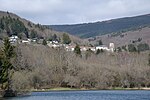
Pic de Nore
Landforms of AudeLandforms of Tarn (department)Mountains of Occitania (administrative region)Occitania (administrative region) geography stubs

The pic de Nore (Occitan: Nòra) at 1,211 metres (3,973 ft) is the highest point in the Montagne Noire, on the border of the Aude and Tarn departments, near to the Parc naturel régional du Haut-Languedoc in southern France. The Arnette and Clamoux rivers both have their sources on the slopes.
Excerpt from the Wikipedia article Pic de Nore (License: CC BY-SA 3.0, Authors, Images).Pic de Nore
D 87, Carcassonne
Geographical coordinates (GPS) Address Nearby Places Show on map
Geographical coordinates (GPS)
| Latitude | Longitude |
|---|---|
| N 43.424444444444 ° | E 2.4627777777778 ° |
Address
D 87
11380 Carcassonne
Occitania, France
Open on Google Maps


