place

Blackwater Valley Path

Footpaths in HampshireFootpaths in SurreyHampshire geography stubsLong-distance footpaths in EnglandSurrey Heath
Use British English from February 2017
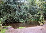
Blackwater Valley Path in winter

The Blackwater Valley Path follows the River Blackwater from its source in the Rowhill Nature Reserve in Aldershot to just beyond the point where it joins the River Whitewater near Swallowfield to become the Broadwater. This long-distance route covers 23 miles (37 km) and closely follows the River Blackwater using public rights-of-way as well as permissive footpaths and is waymarked. It is looked after by the Blackwater Valley Countryside Partnership.The Surrey Heath section includes informal parks on reclaimed land at Blackwater Park and Watchmoor.

Excerpt from the Wikipedia article Blackwater Valley Path (License: CC BY-SA 3.0, Authors, Images).

Blackwater Valley Path
Farnborough Road, Waverley

Geographical coordinates (GPS) Address Nearby Places
placeShow on map

Wikipedia: Blackwater Valley PathContinue reading on Wikipedia

Geographical coordinates (GPS)

Latitude Longitude
N 51.24 ° E -0.786 °
placeShow on map

Address

TGA Living

Farnborough Road 174
GU9 9AX Waverley
England, United Kingdom
mapOpen on Google Maps

Blackwater Valley Path in winter
Share experience

Nearby Places

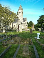
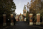
Upper Hale Cemetery, Farnham

Upper Hale Cemetery (also known as Hale Cemetery) is the burial ground for the district of Hale in Farnham in Surrey. Hale grew rapidly after 1854 when the British Army became established in nearby Aldershot in Hampshire. At this time many people came to the area seeking employment in building Aldershot and the military barracks. As the cottages spread, those nearer to Aldershot formed a separate village, which became known as Heath End. As more homes were built and the local population expanded it soon became obvious that a new burial ground at Hale was needed as the churchyard at St John the Evangelist Church in Hale gradually began to fill. Locals could also be buried at the new cemetery at West Street Cemetery in town, also known as Farnham Cemetery, and at Badshot Lea Cemetery. However, Farnham Burial Board advised St John the Evangelist church in Hale to apply for Common land from the War Office. Funds to purchase the land for a new cemetery and to build the two small chapels came from the Hale Poor rates and in 1872 the War Office provided 2 acres (0.81 ha) of land as a burial ground for the people of Upper Hale. The church of St Mark the Evangelist was built opposite the cemetery in 1883. It took 8 months to convert the rough land into ground suitable for a cemetery and to build the two chapels in addition to walling the area and marking out the land. Upper Hale Cemetery was consecrated by Samuel Wilberforce, the Bishop of Winchester on 1 November 1872 and the first burial took place two weeks later on 27 November 1872. The two small chapels in the cemetery are now derelict with large areas of each roof badly damaged and exposed to the elements. They are currently (2020) in the process of being renovated by Farnham Town Council with the addition of a link extension to join the two buildings together to create a single building. The chapels cannot be used for residential homes and a community use for them is being discussed.Upper Hale Cemetery has 20 burials from the two World Wars – 16 from World War I and 4 from World War II with their distinctive Commonwealth War Graves Commission headstones. Among the WWII burials is Pte. Maud Rose Payne (1925–1945) of the Auxiliary Territorial Service who was from Farnham.