Wattstown
1887 in Wales1905 disasters in the United Kingdom1905 in Wales1905 mining disasters19th-century mining disasters ... and 4 more
AC with 0 elementsCoal mining disasters in WalesRhondda ValleyVillages in Rhondda Cynon Taf

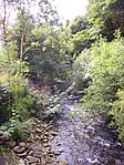
Wattstown (Welsh: Aberllechau) is a village located in the Rhondda Valley in the county borough of Rhondda Cynon Taf, Wales. Located in the Rhondda Fach valley it is a district of the community of Ynyshir. Prior to mid 19th century industrialisation the area was once little more than a wooded area, sparsely populated by farmsteads. With the coming of the coal industry Wattstown became a busy, densely populated village, but with the closure of the collieries Wattstown suffered an economic downturn that still affects the village today. Wattstown is named after Edmund Hannay Watts, who at one time owned the National Colliery in Wattstown.
Excerpt from the Wikipedia article Wattstown (License: CC BY-SA 3.0, Authors, Images).Wattstown
Aberllechau Road,
Geographical coordinates (GPS) Address Nearby Places Show on map
Geographical coordinates (GPS)
| Latitude | Longitude |
|---|---|
| N 51.634101 ° | E -3.419632 ° |
Address
Aberllechau Road
Aberllechau Road
CF39 0PA , Ynyshir
Wales, United Kingdom
Open on Google Maps


