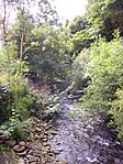
Ynyshir

Ynyshir is a village and community located in the Rhondda Valley, within Rhondda Cynon Taf, South Wales. Ynyshir is pronounced (ənɪs-hiːr) according to the International Phonetic Alphabet (IPA), and means "long island" in Welsh. The village takes its name from a farm in the area, falling within the historic parishes of Ystradyfodwg and Llanwynno (Llanwonno). The community of Ynyshir lies between the small adjoining village of Wattstown and the larger town of neighbouring Porth. Ynyshir has its own library, post office, doctor's surgery and a number of shops and other significant amenities, although these represent a fraction of the businesses that once fronted the main road – Ynyshir Road during the village's heyday. It is also home to local football teams Ynyshir Albions and Ynyshir and Wattstown Boys Club.
Excerpt from the Wikipedia article Ynyshir (License: CC BY-SA 3.0, Authors, Images).Ynyshir
A4233,
Geographical coordinates (GPS) Address Nearby Places Show on map
Geographical coordinates (GPS)
| Latitude | Longitude |
|---|---|
| N 51.622844 ° | E -3.409818 ° |
Address
A4233
CF39 0RD , Ynyshir
Wales, United Kingdom
Open on Google Maps


