place

James Burnham House

1677 establishments in the Massachusetts Bay ColonyEssex County, Massachusetts Registered Historic Place stubsHouses completed in 1677Houses in Ipswich, MassachusettsHouses on the National Register of Historic Places in Essex County, Massachusetts
National Register of Historic Places in Ipswich, Massachusetts
IpswichMA JamesBurnhamHouse

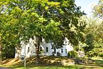
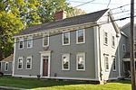
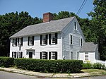
The James Burnham House is a historic First Period house in Ipswich, Massachusetts. Burnham, who was apparently a wealthy man, lived in three different houses in the area from the 1670s to 1703. This is house is believed to be one that he purchased from Samuel Poad in 1677, based on what is known of the various properties and related transactions. The main body of the house exhibits no exposed evidence of its 17th century origins, but analysis of its structure reveals a set of features that make it nearly certain that it was built well before 1700. These diagnostic features include unusually large rooms, of a scale comparable to others in Ipswich, a spacing between joists that is distinctive to pre-1683 Ipswich houses, and a relatively steep roof pitch. Most of these features were covered over by alterations made to the interior during the Federal period, and the building's attic space has been finished over. A two-story ell was added onto the back of the house in the 19th century, and a porch was added in the 20th.The house was listed on the National Register of Historic Places in 1990.

Excerpt from the Wikipedia article James Burnham House (License: CC BY-SA 3.0, Authors, Images).

James Burnham House
Heartbreak Road,

Geographical coordinates (GPS) Address Nearby Places
placeShow on map

Wikipedia: James Burnham HouseContinue reading on Wikipedia

Geographical coordinates (GPS)

Latitude Longitude
N 42.664722222222 ° E -70.830277777778 °
placeShow on map

Address

Heartbreak Road 35
01936
Massachusetts, United States
mapOpen on Google Maps

IpswichMA JamesBurnhamHouse
Share experience

Nearby Places

Benjamin Stickney Cable Memorial Hospital

The Benjamin Stickney Cable Memorial Hospital is a historic hospital building at the junction of Massachusetts routes 1A and 133 in Ipswich, Massachusetts, U.S. The Colonial Revival building was built in 1917, following an extended fundraising effort, begun in 1906 and pushed further along by philanthropist and Castle Hill owner Richard T. Crane, Jr., after the 1915 death in a car accident of his friend, Benjamin Stickney Cable. Crane purchased the land on which the building sits and made a further donation of $145,000 to the construction fund.The building was designed by noted hospital architect Edward F. Stevens in a Georgian Revival style designed to harmonize with the rich colonial heritage of Ipswich. The original part of the building is a 2+1⁄2-story brick-and-terracotta structure in the shape of an H. A major addition in 1961 added a wing to the east side of the building, doubling the available space from 20 to 41 beds, and a dining hall was built into the slope of a hill on the east side of the patients' terrace at the rear of the original building. The most notable architectural parts of the building interior are Memorial Hall and the patients' day room, both richly detailed with paneled wainscoting, leaded-glass French doors, and ornate crown molding.The hospital closed its doors in 1980, and the building was converted to apartments in the late 1980s. It was listed on the National Register of Historic Places in 1990, although the 1961 additions do not contribute to this listing.

South Green Historic District (Ipswich, Massachusetts)

The South Green Historic District encompasses one of the oldest central civic parts of Ipswich, Massachusetts. The town's South Green was laid out in 1686, and is now the heart of a collection of historic properties dating from the 17th to the 19th century. The centerpiece of the district is the green itself, and its most notable associated property is the John Whipple House, a National Historic Landmark and museum. The district boundaries extend from the junction of South Main and Elm Streets, southward past the green to where County Road (Massachusetts Route 1A) crosses Saltonstall's Creek.Ipswich voted to establish the South Green in 1686, after which it was used as a common grazing area, and as a training ground for the local militia. It was also the site of Ipswich's earliest school buildings, which even predated the establishment of the green as a common area. The first schoolhouse was built in the area in 1652; it was moved to the Meetinghouse Green in 1704, at which time private education continued in the area. A public school was again introduced to the South Green area in 1794, which became the English High School from 1836 to 1874.Most of the surviving structures in the district are houses. The oldest is the c. 1653 Whipple House, which was moved to the area in the 1930s. The green is flanked by buildings dating through the 19th century, in a variety of styles. The predominant styles are Georgian, Federal, and Greek Revival, although there are several later Victorian properties. The district was listed on the National Register of Historic Places in 1980.