place

Ipswich Camp

Buildings and structures in Ipswich, MassachusettsInstallations of the U.S. Army in MassachusettsMassachusetts building and structure stubs

Ipswich Camp was a former infantry and field artillery coastal defense base camp that existed from between May 1942 and November 1943 in Ipswich, Massachusetts, USA. Company L of the 181st Infantry Regiment was stationed at the camp, alongside Battery B of the 211th Field Artillery Battalion, part of the forces of the Eastern Defense Command for defending the United States. The infantry company patrolled between Newburyport and Lynn, while the field artillery battery was located along several earthwork positions along the coast.

Excerpt from the Wikipedia article Ipswich Camp (License: CC BY-SA 3.0, Authors).

Ipswich Camp
Old England Road,

Geographical coordinates (GPS) Address Nearby Places
placeShow on map

Wikipedia: Ipswich CampContinue reading on Wikipedia

Geographical coordinates (GPS)

Latitude Longitude
N 42.6756 ° E -70.8269 °
placeShow on map

Address

Old England Road 15
01938
Massachusetts, United States
mapOpen on Google Maps

Share experience

Nearby Places

East End Historic District (Ipswich, Massachusetts)

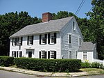
The East End Historic District encompasses the historic eastern portion of central Ipswich, Massachusetts. The now predominantly residential district is bounded on the north and west by East Street, running from its junction with North Main and High Streets to Jeffrey's Neck Road. The eastern boundary includes the Ipswich River and Turkey Shore Road from its junction with Labor-in-Vain Road to Green Street, and the southern boundary runs along Green Street to North Main. The district was listed on the National Register of Historic Places in 1980.Historically, the district encompasses the part of Ipswich that served as its access to the sea. The very earliest structures in the new settlement were built in the area near what is now Town Wharf, and development radiated from that point. In the early years, this was a center of economic activity, with lumber and fishing interests shipping their products out. A shipbuilding industry was active in the area, and there were workshops for a diversity of trades, including pottery and tanning.By the 19th century these early industries were in decline, and industrial activity in other parts of the town took over in importance, so the area began to develop a more residential character. The early First Period, Georgian, and Federalist houses began to be joined by 19th century housing featuring Greek Revival, Second Empire, and Italianate architecture. The Green Street bridge tied the area to the South Green area, leading to some further development along Turkey Shore Road, south of the Ipswich River. The district has more than sixty houses representing these periods of development.

South Green Historic District (Ipswich, Massachusetts)

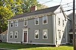
The South Green Historic District encompasses one of the oldest central civic parts of Ipswich, Massachusetts. The town's South Green was laid out in 1686, and is now the heart of a collection of historic properties dating from the 17th to the 19th century. The centerpiece of the district is the green itself, and its most notable associated property is the John Whipple House, a National Historic Landmark and museum. The district boundaries extend from the junction of South Main and Elm Streets, southward past the green to where County Road (Massachusetts Route 1A) crosses Saltonstall's Creek.Ipswich voted to establish the South Green in 1686, after which it was used as a common grazing area, and as a training ground for the local militia. It was also the site of Ipswich's earliest school buildings, which even predated the establishment of the green as a common area. The first schoolhouse was built in the area in 1652; it was moved to the Meetinghouse Green in 1704, at which time private education continued in the area. A public school was again introduced to the South Green area in 1794, which became the English High School from 1836 to 1874.Most of the surviving structures in the district are houses. The oldest is the c. 1653 Whipple House, which was moved to the area in the 1930s. The green is flanked by buildings dating through the 19th century, in a variety of styles. The predominant styles are Georgian, Federal, and Greek Revival, although there are several later Victorian properties. The district was listed on the National Register of Historic Places in 1980.